
An estimated 4 million miles of vehicular roads run through the United States, and they fragment habitat, alter animal behavior, isolate populations of wildlife, and impose wildlife mortality that is often both spatially concentrated and taxonomically selective. In addition to the ecological toll, the economic and human costs of wildlife-vehicle collisions (WVCs) are profound. According to a 2026 report from the Pew Charitable Trust, WVCs in the United States cost an estimated $10 billion annually and result in approximately 200 passenger deaths and 26,000 injuries.
For decades, researchers have documented that WVCs tend to cluster where animal movement, appropriate habitat features, and traffic intersect, locations known as “roadkill hotspots” or “wildlife hotspots.” Road ecologists (those scientists who study the ecological effects of roads) often focus on the degree of “connectivity” in a system when trying to identify areas that may be more prone to WVCs. In a general sense, connectivity refers to how easy it is for organisms to move across a given area, and road ecologists often find higher rates of WVCs where roads cross areas of high connectivity.
Despite impressive gains in our understanding of when and where roadkill hotspots are likely to occur, large gaps remain, especially regarding our understanding of connectivity. To help address these gaps, researchers from University of New Hampshire and the New Hampshire Department of Transportation conducted a study focused on developing a more nuanced understanding of connectivity and risk of WVCs in the state.
New Hampshire is still largely forested but is increasingly shaped by suburban growth and expanding road networks. Using police-reported wildlife collision records from 2015 to 2021, researchers identified 40 hotspots: road segments with consistently high numbers of WVCs involving medium- and large-bodied animals such as deer, moose, bears, and turkeys. They asked three main questions: What affects the frequency of WVCs among hotspots? Why do certain road segments experience more WVCs than nearby roads? And how do hotspot roads compare to roads across the state as a whole?
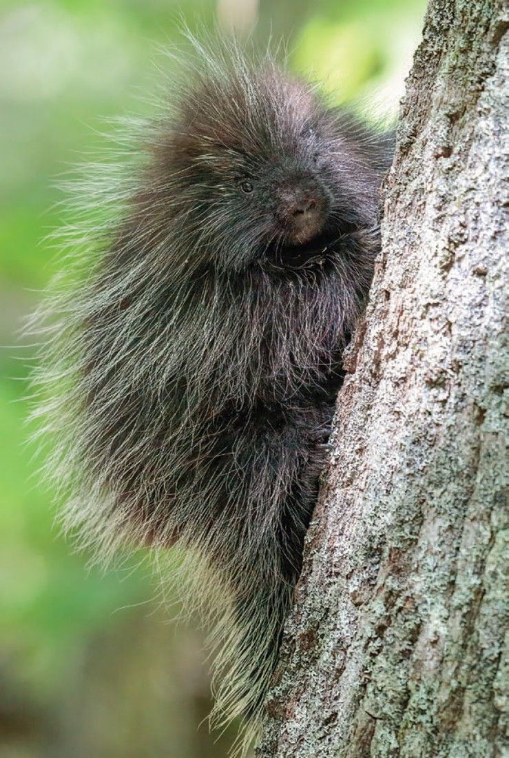
To answer these questions, the authors compared different factors that might influence WVCs, including how connected the surrounding habitat was, how much traffic used the road, and how much forest or farmland was nearby. The authors tested four connectivity models: one based on movement patterns for “habitat generalists” (for example, black bears), which can live in a wide variety of environments and use many different food resources; one for “area-sensitive” species (for example, bobcats), which require large habitats; one for “barrier-sensitive” species (for example, porcupines), which are those that are especially impacted by roads and their associated infrastructure; and one for “general wildlife” movement. The authors used a step-by-step approach to evaluate not just where collisions happen, but why some places are riskier than others.
In the May 2025 issue of the journal Environmental Management, the researchers reported that, counter to their expectations, WVCs tended to be lower in areas with higher connectivity. Of the four connectivity models, the barrier-sensitive species model best explained patterns of roadkill: areas with higher levels of connectivity from a barrier-sensitive species’ perspective had fewer WVCs. The authors also found that hotspot areas did not differ from non-hotspots on nearby roads or from roads statewide in degree of connectivity or land cover, but that hotspots did have higher traffic volume. Even so, WVC intensity peaked at moderate traffic levels, with fewer collisions on the busiest roads, likely because heavy, consistent traffic deters animals from approaching and crossing roads.
The authors suggest that their results might differ from those of studies conducted in other areas because connectivity is likely species-specific and context dependent. For example, in highly fragmented landscapes, corridors (positively linked to connectivity) may funnel animals toward roads, thereby increasing collision risk, while in more intact ecosystems, increased levels of connectivity may disperse animal movement across space and reduce risk at any single location.
These findings indicate that species’ behavior and broader landscape context are critical for understanding where and why WVCs occur in any given area.