
Just as author Allaire Diamond and the Northern Woodlands editorial team were finishing work on the Autumn 2023 feature article, “Building Beaver Dam Analogs to Restore Watersheds,” an extreme rain event hit the Northeast. The July 10-11 floods in New York and Vermont made national news, and were among several extreme summer weather events that provoked widespread coverage of the intensifying effects of climate change. According to Diamond, the floods also inspired broader discussions of the value of wood in rivers. “We are not seeing the immediate response of pulling trees out of the way, as we did after Tropical Storm Irene,” she noted.
In her work leading wetland and stream restoration projects for the Vermont Land Trust (VLT), Diamond has had many opportunities to inspect flooding impacts, including at locations where – as described in the autumn article – staff and volunteers from VLT, the Memphremagog Watershed Association, The Nature Conservancy, and the NorthWoods Stewardship Center had previously installed beaver dam analogs (BDAs) and other structures to enhance degraded waterways. Diamond has been pleased to see that, at many of these sites, the structures remained in place and have helped to slow and spread floodwater horizontally into floodplains, reducing downstream flow.
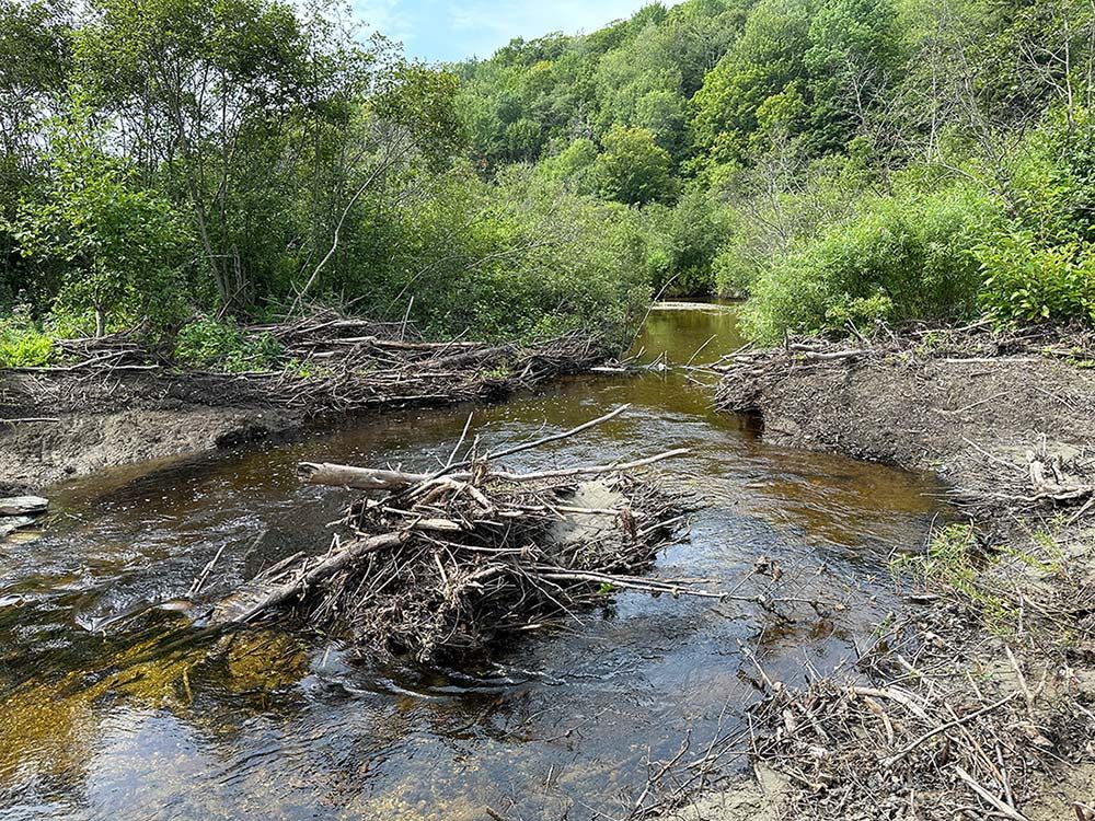
Recently, while accompanying herpetologist Kiley Briggs from the Orianne Society, a nonprofit that focuses on the conservation of reptiles, amphibians, and their habitats, Diamond observed the July flooding’s impact in an active beaver wetlands. This site includes both intact and old, blown out dams, and features a diverse mix of habitats, including alder swamp, floodplain forest, cattail marshes, and sedge meadows. At least one dam appeared to have failed during the flooding, as evidenced by piles of dam material all around a raw-looking flowing channel. Other dams were still intact, however, including one, located upstream from a road culvert, which likely prevented floodwater from overwhelming that culvert. “What I found most interesting was the way that the complexity of this area, which was shaped by beavers, provided many different places for floodwaters to go,” said Diamond. “The water spread out across the entire valley – including little pools, depressions, old river and stream channels, and marshy wetland areas.”

Diamond and Briggs were at the site to check on the status of resident wood turtles previously tagged with GPS transmitters. They were pleased to confirm that the turtles had survived the floods and weren’t washed downstream, an outcome no doubt attributable to the many sheltered areas within their complex habitat. “The meadows left behind when beaver dams wash out make really great feeding grounds for wood turtles, and the turtles sometimes overwinter beneath beaver dams,” Briggs noted. “Beavers can enrich wood turtle habitat in many other ways, too.”
Discussion *