
Maintaining Vital Connections within the Lake Champlain Watershed

Caleb Kenna has been photographing Vermont’s people and landscape for 25 years. In this visual exploration, Kenna spotlights a few of the many waterways that feed into Lake Champlain. These photographs, taken both from ground level and (by drone) from the air, illustrate stories of restoration, stewardship, and science that contribute to a resilient Lake Champlain system.
A healthy lake depends, in part, on the quality of the waters that flow into it. Myriad rivers, streams, and wetlands drain into Lake Champlain and influence drinking water, economic and recreation opportunities tied to local communities, and the ability of fish and wildlife populations to thrive. The Lake Champlain Basin – or watershed – encompasses more than 8,200 square miles. Diverse cultures comprise the communities here; their historic and contemporary activities on the landscape shape how resilient the lake system is over time. More than half of the watershed is in Vermont, with 37 percent in New York – cascading down the forested slopes of the Adirondacks – and 7 percent in Quebec, where the lake drains into the Richelieu River.
Similar to other large watersheds in the Northeast, many of the waterways in the Basin have been degraded by factors including pollution, increased sedimentation as a result of forest clearing for farms and development, and overfishing. The loss of riparian forests, filling of wetlands, and straightening or dredging of rivers and streams over time have compromised the ability of the hydrologic system to accommodate recurring flood events. Decreased water quality resulting from habitat loss affects human and wildlife communities alike.
Innovative partnerships to restore riparian areas – to protect critical fish and wildlife habitat, and to conduct long-term scientific monitoring across town, state, and international borders – point toward a hopeful future. A common understanding in these partnerships is that healthy forests are key to protecting Lake Champlain, the waterways that feed it, the communities that depend on its resources, and all the creatures that inhabit the region.
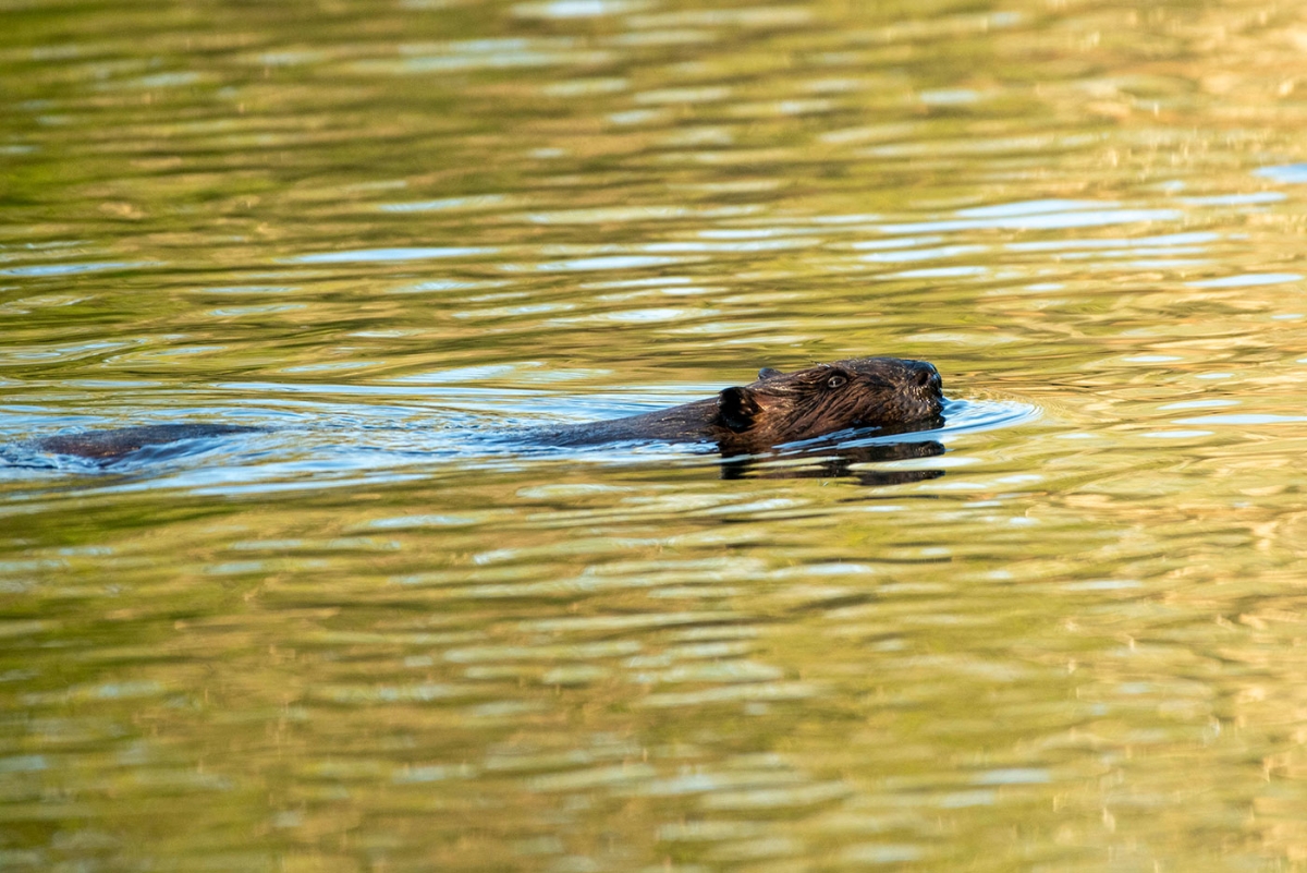
Otter Creek

Otter Creek, Vermont’s longest river, flows out of the heart of the Green Mountain National Forest. As the river makes its way to Lake Champlain, it passes through a rich mosaic of forestland, low-lying valleys checkered with agricultural fields, and quintessential rural town centers. It feeds the network of wetlands comprising the expansive Otter Creek Swamp and is replenished in return. Historically, indigenous peoples of the region used the river as an important travel corridor and cultivated crops in the Otter Creek floodplains to support nearby villages. In urban centers such as Middlebury and Vergennes, its flow over steeper ledges inspired industrial entrepreneurs of the 1700s and 1800s to use its strength to power mills and provide electricity to communities; several hydropower facilities remain. Otter Creek helped build Vermont’s forest-based and agricultural economies. However, this wasn’t without impact to the river’s health and its ability to handle extreme rain events. During Tropical Storm Irene in 2011, communities along Otter Creek that were downstream of protected riparian areas and Otter Creek Swamp – where the floodplain wetlands slowed the water and allowed the river to expand – had far less damage than those communities upstream of the wetland complex.
Local, state, and federal entities, academic institutions, and conservation groups are working together in communities along Otter Creek to restore and protect riparian forests, reduce agricultural runoff, and develop best management practices (BMPs) for stormwater. Sedimentation and stream bank erosion continue to impact the health of the Otter Creek system and the quality of water that flows into Lake Champlain.

-
Learn more about restoration of these wetlands at bit.ly/VermontWetlands.
-
Water quality reports can be found at acrwc-acrpc.hub.arcgis.com.
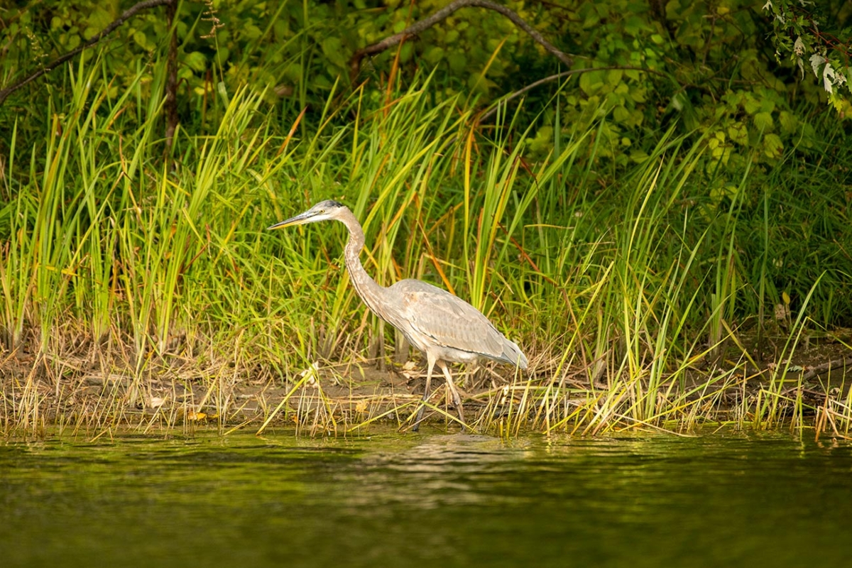
Missisquoi National Wildlife Refuge

The Missisquoi National Wildlife Refuge was established in 1943 on the eastern shore of Lake Champlain to protect important feeding, resting, and breeding habitat for migratory birds. The 6,729-acre refuge comprises a network of biologically rich wetland habitats and supports more than 200 species of birds, including the largest concentration of waterfowl on Lake Champlain. The refuge hosts Vermont’s only nesting population of black terns, listed in the state as endangered. While much of the land within the refuge system is maintained as natural wetlands and open fields to provide nesting and foraging habitat for waterfowl and grassland birds, mixed hardwood uplands add to the diversity of habitat types available for forest-dependent migratory songbirds and other wildlife. Keeping intact those forests that are adjacent to and upstream of the refuge is critical to ensuring clean water both in the refuge and in Lake Champlain, along with high-quality recreational experiences.
“One of the principal threats to refuge biological integrity is water quality,” said Ken Sturm, Missisquoi National Wildlife Manager. “Increasing buffer areas between the river and agricultural and developed lands upstream and restoring them to riparian habitat will help reduce phosphorus runoff and protect and improve water quality on the refuge and in Lake Champlain.”
-
For more information about Motus tracking, see the Spring 2022 issue of Northern Woodlands.
-
Find out more about Motus in the Northeast at northeastmotus.com/contact.
-
Discover more about the Missisquoi National Wildlife Refuge at fws.gov/refuge/missisquoi/visit-us.
-
Find out ways to get involved through the Friends of the Missisquoi National Wildlife Refuge at friendsofmissisquoi.org.
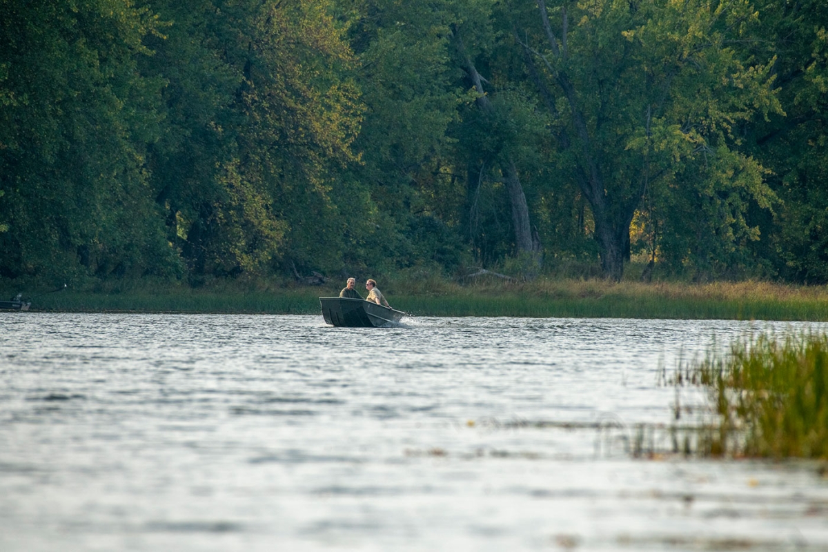
The Winooski River

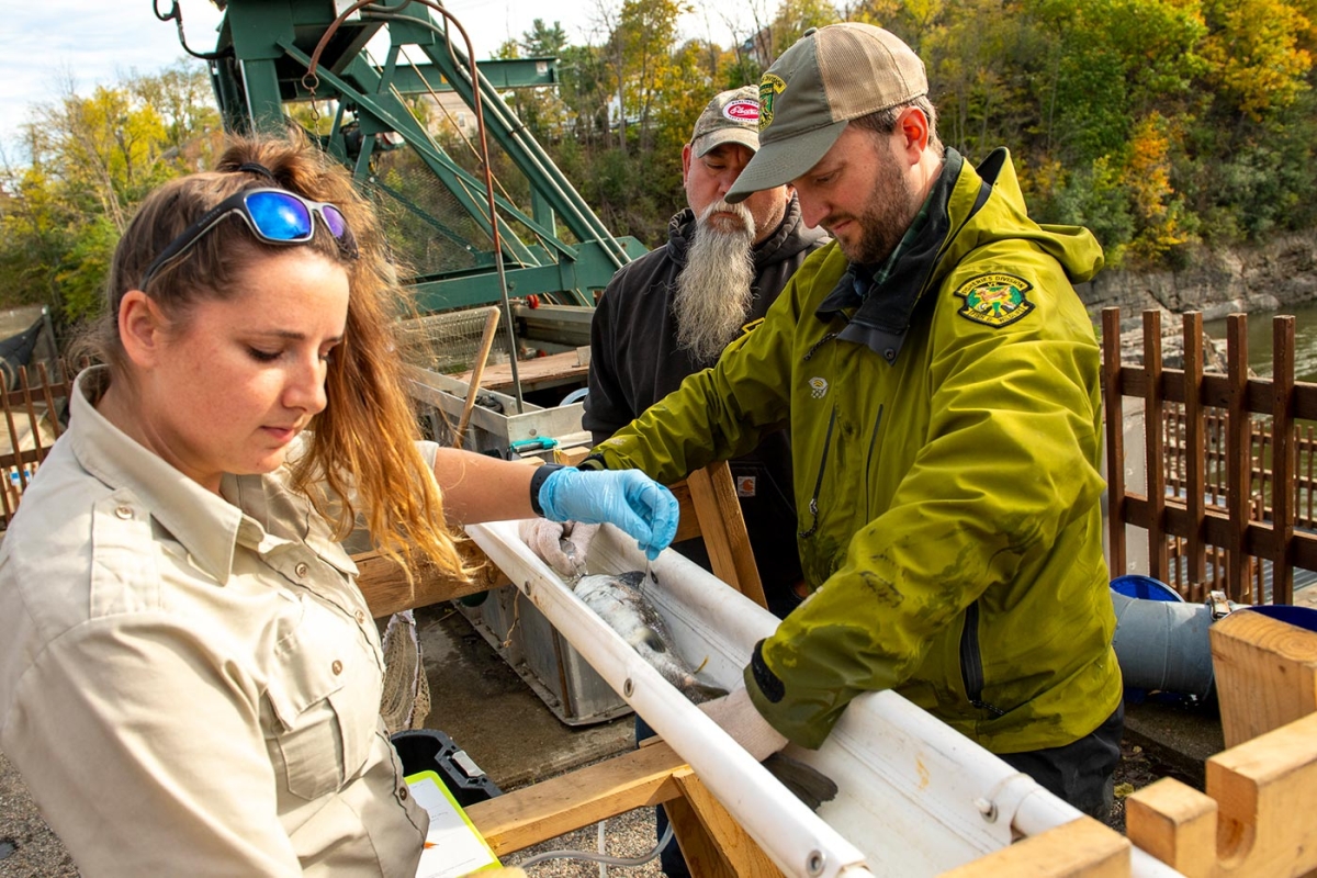
The Winooski River flows 90 miles in a northwesterly direction from Cabot, Vermont, to Lake Champlain. More than 70 percent of the river’s watershed is forested, and the river provides critical spawning and juvenile rearing habitat for landlocked Atlantic salmon. Since 1972, the U.S. Fish & Wildlife Service, Vermont Fish & Wildlife Department, and New York State Department of Environmental Conservation have been working to restore landlocked salmon to their historic range in the Lake Champlain Basin. In the Winooski River, this partnership has also worked with hydropower companies to extend the range of salmon through a trap-and-truck program. Fish are captured and transported upstream past three dams to suitable spawning habitat, near Richmond, Vermont. A milestone was reached on the Winooski River in 2016, when the first natural-born salmon fry was documented in the river in more than 150 years. During the same year, successful spawning of salmon was also documented in the North Branch of the Boquet River in New York.
“Many challenges remain in the effort to reestablish natural spawning populations of salmon. A series of adaptive management experiments are being conducted in the Winooski, Ausable, Saranac, and Boquet rivers to improve restoration efforts. These include testing a variety of stocking locations, genetic brood stock, or conditioning techniques to improve survival and fitness of hatchery-reared salmon released in the wild,” said Kurt Heim, biologist with the U.S. Fish & Wildlife Service. “With continued success of sea lamprey control and declining wounding rates for salmon and lake trout in Lake Champlain, managers hope to see successful spawning and natural production of salmon in these rivers.”

-
Find videos on recent efforts to protect and enhance salmon habitat and to monitor success of the restoration at lcbp.org.
-
The Friends of the Winooski River website offers ways to get involved in stewardship efforts at winooskiriver.org.