
For more than a century, biologists have utilized bird banding for studying avian migration, survivorship, longevity, and reproductive success. It’s an essential tool, but one with a significant limitation: in most instances, birds need to be recaptured in order to read the unique codes on their bands, and the chances of re-sighting a banded bird are incredibly low. Since 1960, more than 40 million songbirds have been banded in North America, but only 1.4 percent were ever recorded again.
Over the past few decades, GPS, satellite, and cellular transmitters have provided more detailed information on bird movements and allowed biologists to retrieve data without recapturing individual birds. However, these technologies are limited – with few exceptions – to larger species that can safely support the added weight.
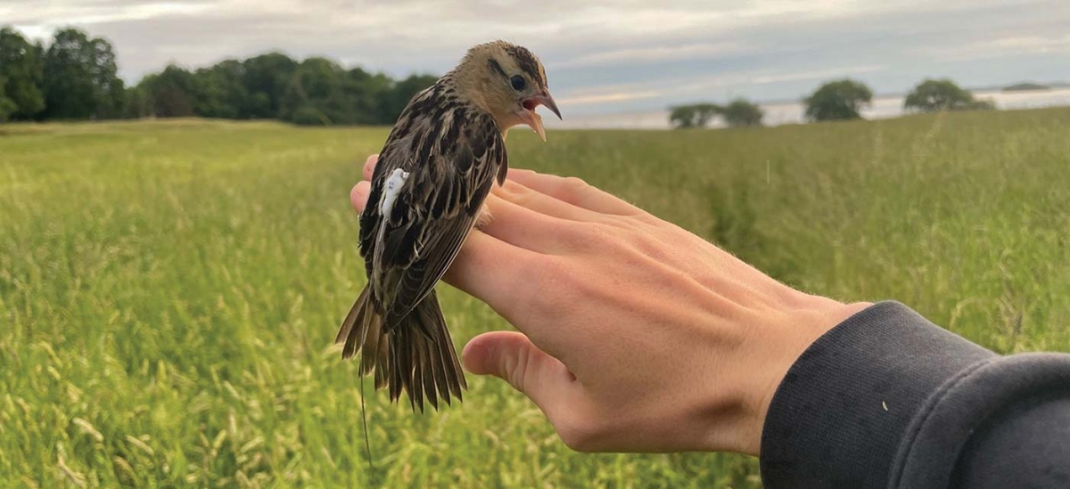
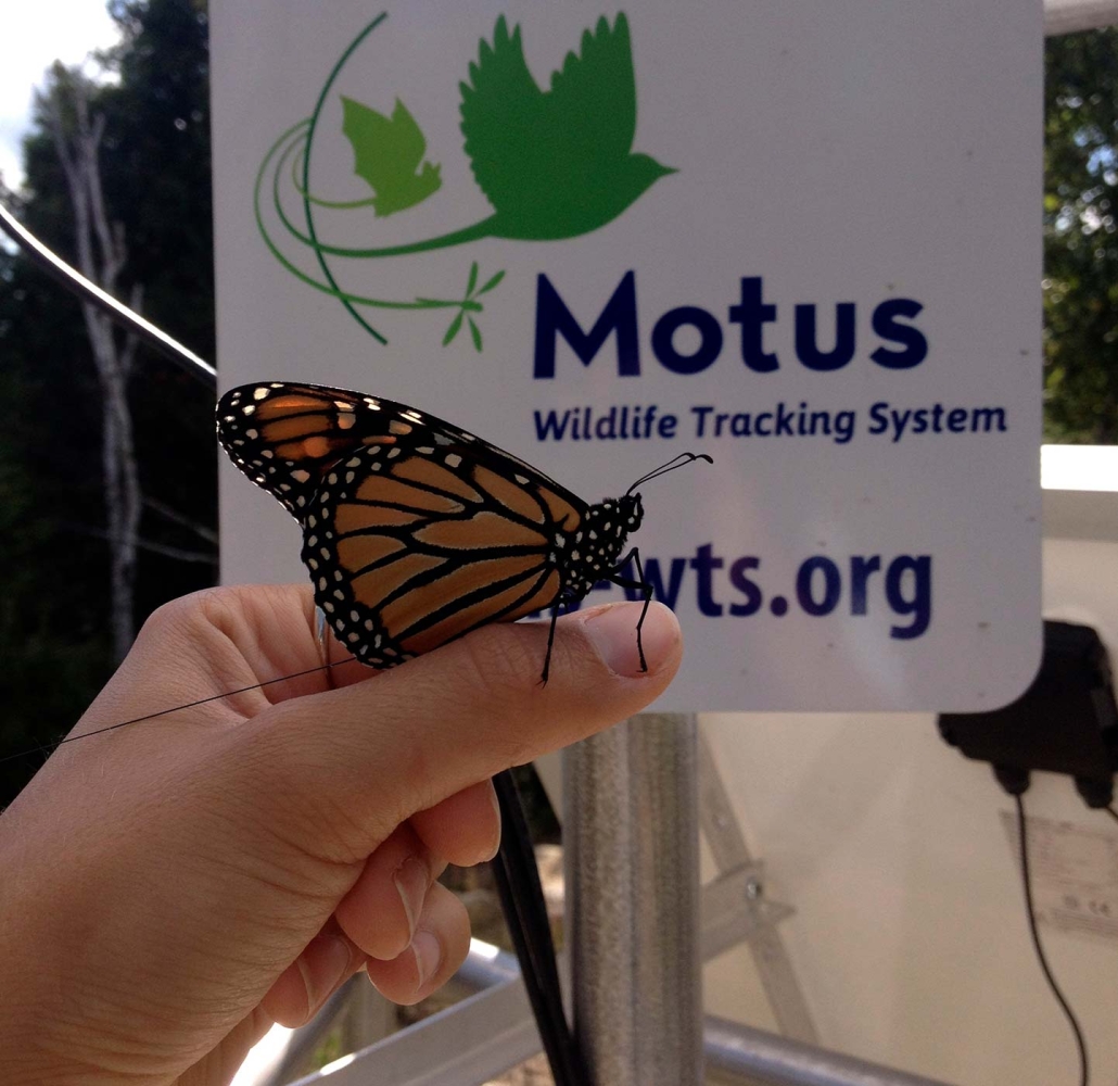
Enter the Motus Wildlife Tracking System, an international research network that is taking the study of winged migration by storm. Named after the Latin word for “motion,” Motus comprises tiny radio transmitters (“nanotags”) – which are affixed to small birds, bats, and even some insects – and a network of receiving stations that detect the radio signals whenever a tagged animal flies within range.
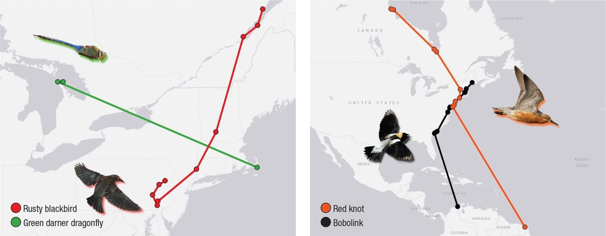
Although it’s existed for less than a decade, Motus has already yielded meaningful data about migration routes, timing, flight speed, stopover behavior, locations of critical migratory and overwintering habitat, and more. From 2014 through 2017, for instance, Motus researchers discovered that a substantial portion of the globally endangered red knot population migrates through Pennsylvania en route to their Arctic breeding grounds each spring – data that now informs siting of ridgetop wind farms.
“It’s the ultimate in collaboration,” says Amber Roth, a biologist from the University of Maine who uses Motus to study golden-winged warblers, Bicknell’s thrushes, and bobolinks, among other species. The more stations in the network, the better the chances of encountering a tagged animal. Every station contributes to the whole, whether or not animals are tagged there. While some data are only available to researchers, anyone can access tag detections and information such as flight paths for individual birds at motus.org, an archive managed by Birds Canada.
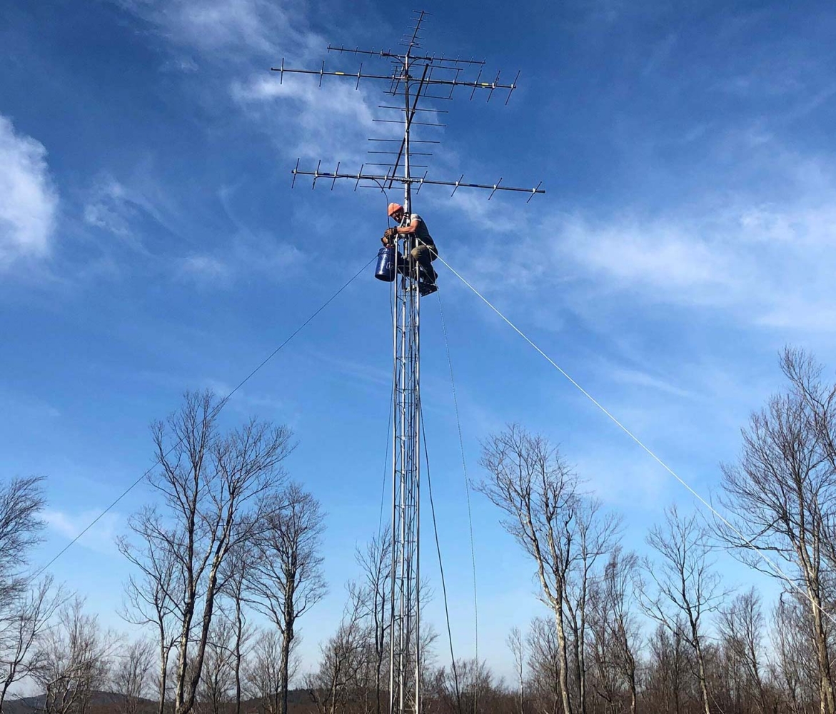
Initial work concentrated primarily on Atlantic, Gulf of Mexico, and Great Lakes coastlines, but a new project aims to establish a series of east-west receiving station “fence lines” to detect tagged wildlife as they migrate north-south through interior New England.
So far, the New England Motus project has added 24 stations on both private and public land in New York, Connecticut, Massachusetts, Vermont, New Hampshire, and Maine, with plans to add another 26 by 2023. Antennas have been installed on windmills, barns, nature centers, old telephone poles, and freestanding towers in fields and other clearings, secured by guy wires and powered by solar panels. It’s an effort Marc Nutter, conservation program director for New Hampshire Audubon, describes as “herculean.”
One of the goals of a new bobolink study led by Roth and Noah Perlut of the University of New England is to pinpoint important migration routes and stopover habitat at a higher geographic resolution than was possible before. Their Motus data will also inform local conservation efforts, such as identifying when bobolinks depart their grassland breeding grounds in order to determine safe haying dates for working farms.
“We have not yet analyzed the data,” cautions Perlut. “That said, one of the most exciting things we’ve learned so far from [bobolinks tagged in the spring and summer of 2021] is the massive importance of the Blackwater National Wildlife Refuge in Maryland. Approximately 25 percent of the 40 birds we tagged spent time on or near that refuge [during their fall migration], some of them staying there for up to 10 days. These data are incredibly informative for thinking about refuge management, and potentially management of adjoining properties as well.”
“The information we’re getting through Motus is redefining our understanding of migration,” reflects Roth.
With nearly 1,300 receiving stations across 31 countries and more than 30,000 tags deployed to date, the conservation potential of Motus is enormous, as is its power to connect people and places that once seemed distant. In tracing any one of the migration maps found on motus.org, we quickly see that “our” birds are “their” birds, too.
Significant funding for the New England Motus project comes from a three-year U.S. Fish & Wildlife Service grant and matching private funds. Partners include New Hampshire Fish and Game, New Hampshire Audubon, Mass Audubon, Maine Audubon, the Maine Department of Inland Fisheries and Wildlife, the Massachusetts Division of Fisheries and Wildlife, the Pennsylvania Game Commission, the Carnegie Museum of Natural History, and the Willistown Conservation Trust. New Hampshire Audubon will be responsible for maintaining the New England infrastructure beyond the grant period.