Rumbles of thunder have grown distant, and the pea-size raindrops that were slamming my face a short time ago have dwindled to a mist. With the rain easing, I notice trickles of water running down the inside of the “rain pants” that are supposed to keep me dry for the next 12 days of solo backpacking through remote forests. There is no cell service, my ride left two hours ago, and the nearest hamlet is a three-day walk from here. There is nothing to do but push on.
Turning a corner in the trail I come face to face with a large, bright blue highway sign nestled in the forest. The sign reads CANADA UNITED STATES BOUNDARY 500' AHEAD PROCEED SLOWLY. Slowly? Why slowly? I stop to take my second picture of the day. The first picture was of Fourth Connecticut Lake, a mere puddle that is the birthplace of the Connecticut River and New Hampshire’s northernmost hiking trail, The Cohos Trail. For 20 years I’ve dreamed of thru-hiking the Cohos.
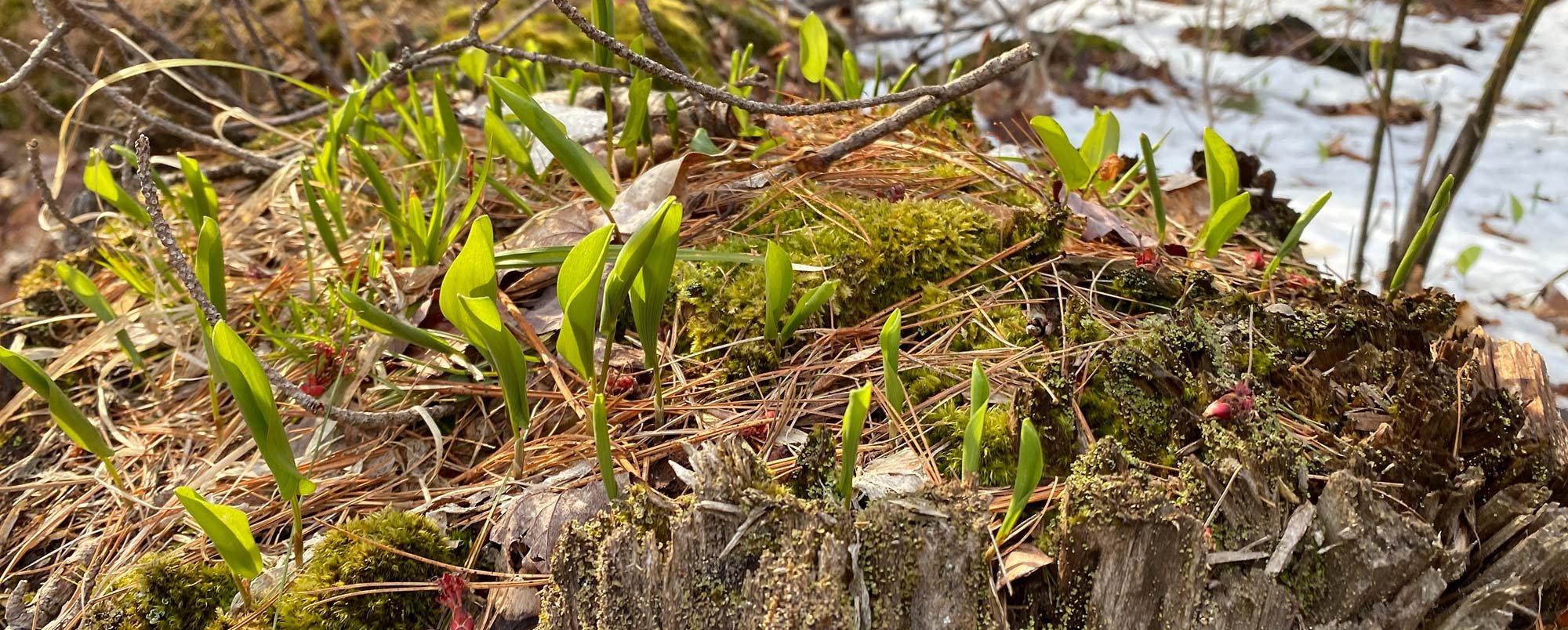
The Cohos (pronounced Co-ahs) Trail runs 170 miles from the border of Canada south along remote ridges, moss-filled valleys, and 4,000-foot summits until reaching the Saco River in Crawford Notch just beyond the Presidential Mountains. The trail, one of the few long-distance trails constructed in a generation, has enchanted me for years. I was born just south of Coös County in Littleton, New Hampshire, 46 years ago. That was right around the time Kim Nilsen, founder of The Cohos Trail, fell in love with the wild forests of Coös County that surrounded his 11-acre homestead in Whitefield, New Hampshire. That homestead was where I learned to walk; Kim Nilsen is my father.

My father’s love affair with the wild, remote landscape of Coös County began in the early 1970s. As a reporter for the Coös County Democrat newspaper, he crossed paths with Arthur Muise, a New Hampshire Fish and Game officer who, according to my dad, could keep him rapt for hours with stories of northern Coös County. One of those stories would eventually change the course of his life. Arthur shared that in 1969, after three days of torrential rain, the earthen dam that held back the 230-acre Nash Pond Bog gave out. The wall of water crashed through the valley into the town of Groveton below, flooding its streets and paper mill and forever changing the riparian habitat and landscape of the forest.
Excitement was in short supply in northern New Hampshire in those days, particularly for a child of the New York City suburbs, so, as my dad tells it, he jumped into his old Datsun car and drove north from Whitefield to what is now the Nash Stream Forest in search of the remnants of the disaster. He found what he was looking for and more.
Standing in the crater of the lake with Arthur’s namesake, Mt. Muise, rising above the distant shore, a vast, deep silence crept into my father’s bones. The silence captivated him, and he returned to explore abandoned logging roads and moose paths whenever he could. In this time of exploration, he discovered pools, waterfalls, and valleys of ferns likely seen by few except hunters, anglers, and timbermen.

It took about two years of roving for my dad to see the possibility of a long-distance trail that would offer the solitude he craved. The trail he imagined would run from the Canadian border along the tall spine of Coös County ending in the wild, largely unexplored Dry River Wilderness in the White Mountains. In 1978, he wrote a passionate editorial in search of support for a long-distance trail. He proposed that visitors to the wild and remote trail would bring with them an economic boon to his neighbors, who were rapidly losing jobs in the forest industry as mechanization took hold and the paper mills shut down. But the volunteer manpower needed to make the trail a reality just didn’t appeal to folks in need of paid work.
As it turned out, times were so hard that our family left our little 11-acre farm in the mountains for the southwest corner of New Hampshire. For nearly 20 years my dad forgot about the trail.
Times were not so easy in southern New Hampshire either. My dad, one of the hardest working, most creative people I know, was not immune to corporate consolidations and mergers, and he found himself out of work several times. Disillusioned and depressed by desk jobs, he began thinking back to his time spent hiking in the silence of the northern mountains and the trail he had once imagined.
One rainy day, while we were on our annual vacation to the Maine coast, my dad began looking at maps of the “North Country” again. Perhaps he was inspired to revisit the maps because the U.S. Forest Service had recently built some 20 miles of trail in the rugged Kilkenny division of the Pilot and Pliny mountain ranges, or perhaps he simply refused to let a rainy day go to waste. Whatever the reason, the Kilkenny was in the heart of the trail he had imagined, and with that section built, the amount of new trail that needed to be cut was much shorter. The trail he dreamed of seemed possible once more.
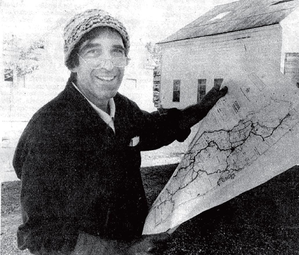
Reenergized, my dad refined his pitch for the trail, continuing to focus on economic development. He placed notices in some of the local papers inviting folks to a meeting in Lancaster, New Hampshire, to learn more about The Cohos Trail proposal. In time, minds and hearts can shift. This time, nearly 50 people showed up for the meeting. The idea for the trail was met with resounding support. And so began The Cohos Trail Association, named “Cohos” instead of Coös because the earliest white explorers to New Hampshire’s northernmost landscape wrote “Cohos” on the maps that they created. Cohos, as it turns out, is an adaptation of the word koas, the Abenaki word for young pine tree. My father felt it was important to acknowledge that history in the trail name.
It wasn’t long after that meeting, while still a young woman, I began hearing stories my dad would tell of his work creating the trail. He spoke of moose nearly stepping on him as he slept in the forest with nothing but a sleeping bag for protection. I learned of grand waterfalls he discovered by following the distant sound of thundering water. I heard of strange places like the Devil’s Hopyard where moss is king and people are guests. But what I remember most is how my dad’s face would change when he spoke of the silence of the Great North Woods. The lines around his eyes would disappear and he would sparkle. He even gave the particular quiet of the north woods a name, “the continental silence,” the sound of only the earth.
. . .
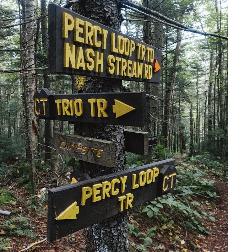
Eight days after starting the trail I find myself supported by the raw wooden floor of the Devil’s Rest shelter. Bruised, blistered, and tired – but also blissfully wrapped in “continental silence” – I look down and see the slanted writing of my father staring back at me from the pages of a small journal. The five Cohos shelters were built after the official opening of the trail 20 years ago. Each was built, in part, by my dad. Each has a journal, and every journal contains his writing; some are faded with age, some are sharp and clear.

Sheltered by the curved timbers of the handmade structure I can almost feel the presence of the many hands that helped my dad bring this shelter and this trail into being. The last nail was pounded here in 2018, a full 40 years after my dad wrote the first editorial about the trail. In 1978, locals wondered what value there could be in a path to nowhere in the Great North Woods. It turns out, thanks to the relentless pace of lives built on technology, that many of us want to, or rather need to, step out of the endless hum of screens into the stillness of the forest. Each year The Cohos Trail welcomes a few more visitors willing to drive for hours in search of deep silence.
It has been three days since I have seen or spoken to another person. From the branches of a young maple, a red-eyed vireo asks “Where are you? Here I am. Where are you?” The only other sound is the slight swish of leaves as a warm breeze stirs the canopy.
I look down at the slanted letters in my lap tracing the faint indentations from the pressure of my father’s hand and smile. I am reminded of the words of another visionary woodsman, Sigurd Olson, who helped draft the Wilderness Act of 1964, “To those devoid of imagination a blank place on the map is a useless waste; to others, the most valuable part.”
I think back to my father, standing alone in the crater of Nash Pond Bog decades ago, and marvel at his imagination, vision, and tenacity. Those traits endure to this day. Seemingly unencumbered by the passage of time, my dad still drives four hours north from his southern New Hampshire home to maintain the section of trail he adopted atop Mt. Gloriette and Dixville Peak or to join a work party somewhere along the 170 miles of trail. Although he hasn’t been president of The Cohos Trail Association for many years, he continues to dream up ideas to improve or expand the trail.
The vireo again asks, “Where are you?”
Far from anywhere I sit in silence with my father’s words and know, for the first time in years, where I am.