The Impact of an Extreme Rain Event on a Headwater Stream in Maine’s Western Mountains
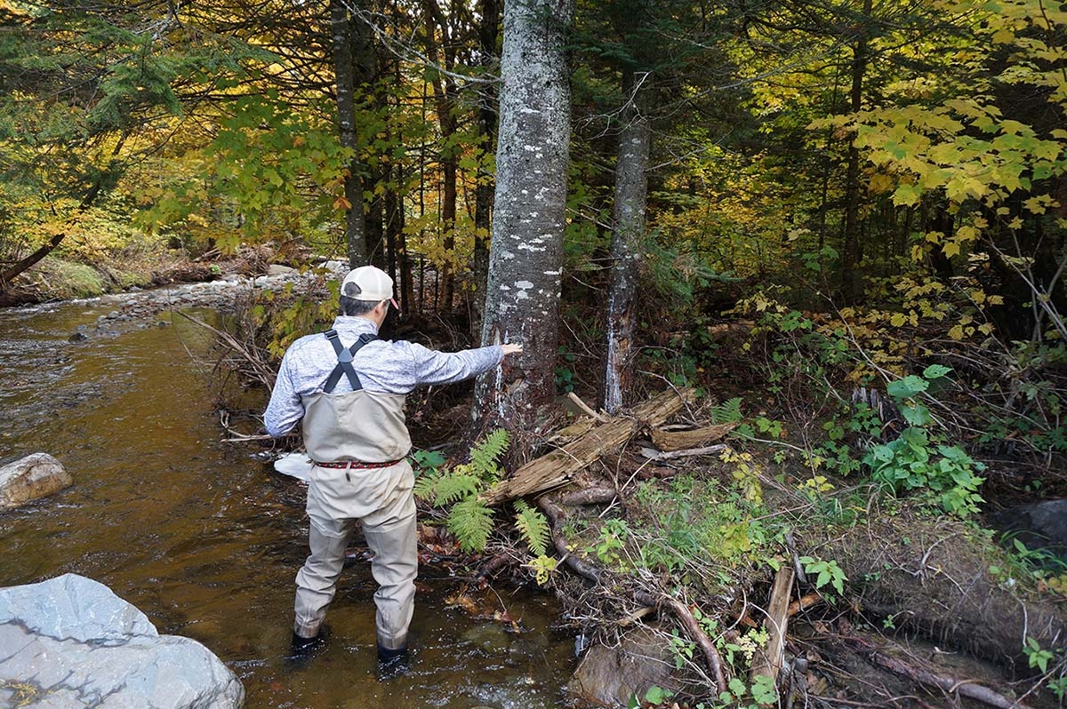
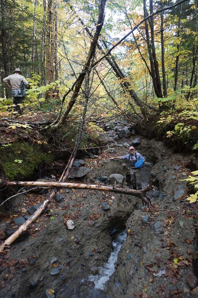
In “At Chapman Brook” (Spring 2021), author Catherine Schmitt describes the important connections between forests and the health of our waterways. The article mentions an extreme rain event that led to severe erosion in a stream upstream of Kennebago Lake in western Maine, including photos that show a failed culvert and stream erosion that went as deep as six feet in some locations. Here’s the rest of the story, contributed by Tim Cook of University of Massachusetts Geosciences program, and Noah Snyder, of Boston College’s Earth and Environmental Sciences Department.
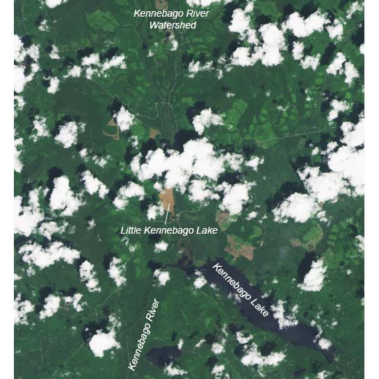
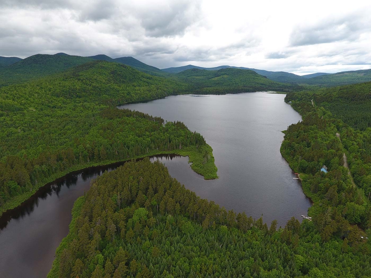
Upper Kennebago River Watershed Case Study
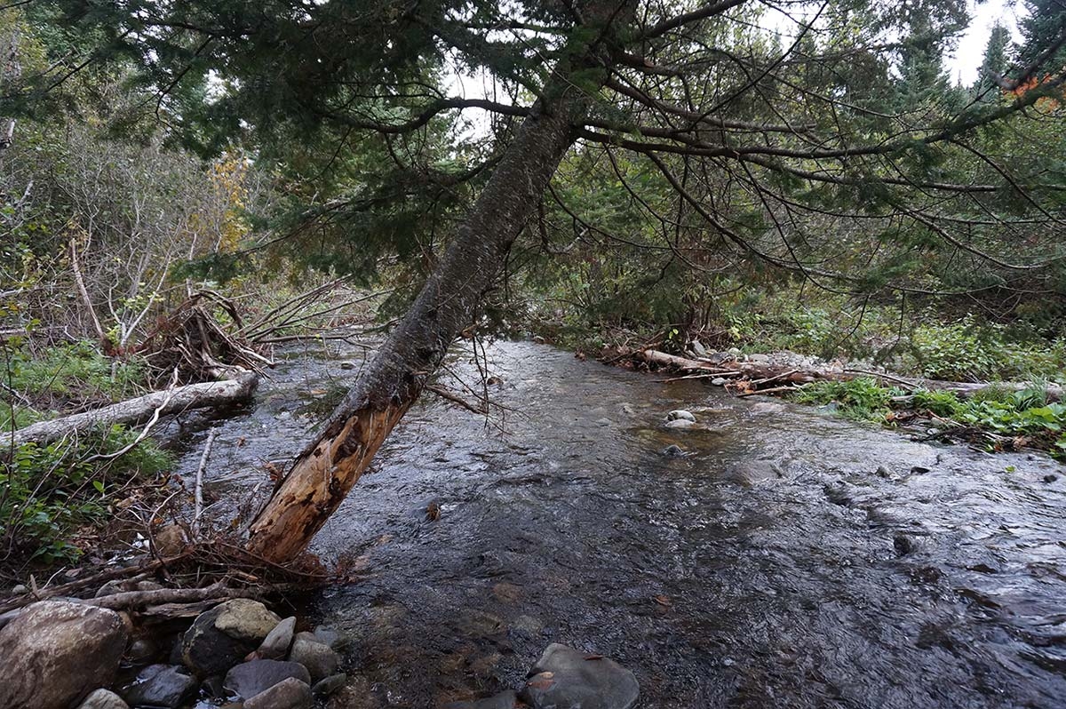
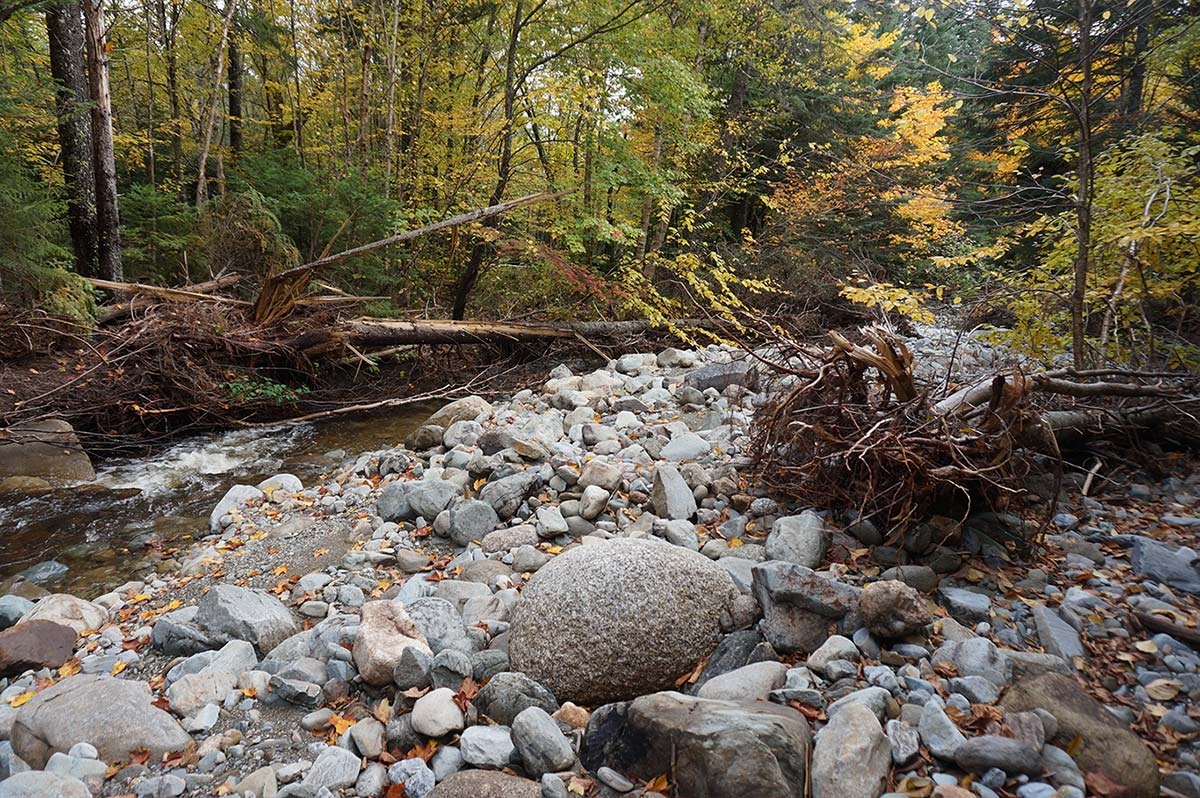
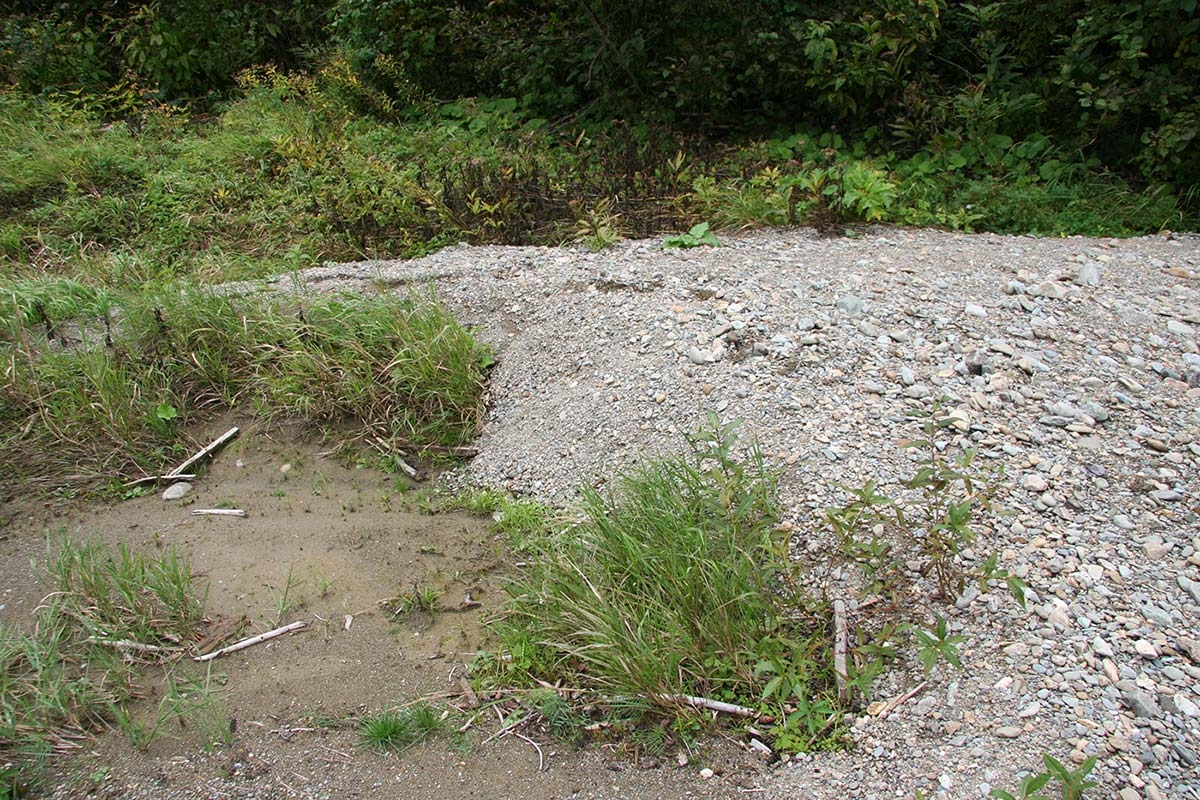
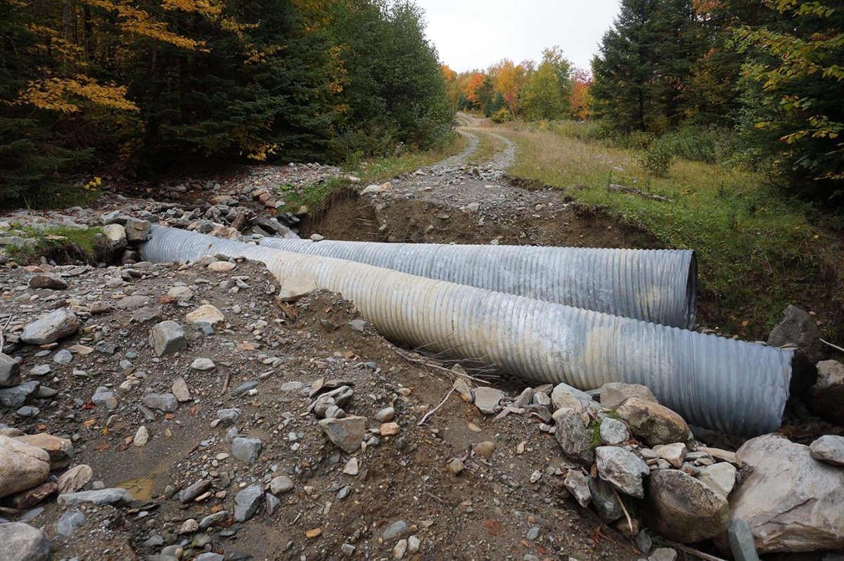
In the early morning hours of July 3, 2018, a rapidly advancing cold front brought a line of showers and thunderstorms across northern New England. In the western Maine mountains, this weather event produced localized extreme rainfall, with up to 4 inches of rain occurring in as little as 2 hours. The rainfall, having occurred too rapidly to be readily soaked up by the ground, produced flooding in some small mountainous headwater streams in the region. In the upper Kennebago River watershed, the floods washed out bridge abutments and culverts where streams were crossed by forest roads. Erosion caused by the floodwaters both widened and deepened stream channels, liberating sediment and carrying it downstream. Sand and gravel were deposited where the river’s slope decreased; mud continued downstream, eventually making its way into Little Kennebago Lake, where the still water allowed sediment to gradually settle out of the water. Satellite images collected later in the day on July 3 reveal the striking mocha color of the floodwaters that entered the lake. Subsequent observations showed that the water would take more than two weeks to return to a more normal color.
Ongoing Climate Change and Watershed Research
Our research team, comprised of students and faculty from the University of Massachusetts Amherst, Boston College, and Worcester State University, began studying Little Kennebago Lake and its watershed in the summer of 2017. The watershed, managed in part for timber harvest, is one in a group of study sites across New England where we are investigating how changing climate and both historical and on-going land uses impact erosion. While the July 2018 rain event in the Kennebago watershed resulted in only localized impacts and limited damage to infrastructure, understanding changes in the erosion of sediment from the landscape and its subsequent transport by rivers is vital to conserving soil resources, preserving high-quality aquatic habitat in rivers and lakes, and evaluating the fate of contaminants in soil and water.
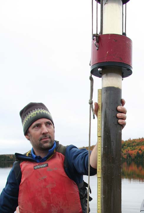
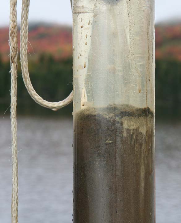
Our research involves collecting sediment cores from the bottoms of lakes and ponds, targeting sites with large inflowing streams that deliver sediment eroded from the surrounding landscape. Over time, changes in the biological, chemical, and physical characteristics of sediment as it gradually accumulates on lake beds provide a record of past conditions within the lake and its surrounding environment.
Sediment cores recovered from Little Kennebago Lake expose changes in the rate at which sediment has been delivered to the lake over the past ~1,200 years and provide context for interpreting climate and land use impacts, as well as rare flood events such as occurred in 2018. This long-term perspective revealed that the 2018 event was not unique or even the most extreme event to have impacted the area. However, sediment delivery from the watershed increased markedly around the year 1900, coincident with the onset of commercial logging in the watershed. An ensuing decrease in sediment delivery likely reflects changes in forestry practices and successful implementation of best management practices following the Federal Water Pollution Control Act of 1972.
Our research in the Kennebago watershed demonstrates both the impacts of early 20th century timber harvest and the efficacy of best management practices in later reducing those impacts. However, the intersection of ongoing changes in climate and land use threatens both forest and aquatic ecosystems. In New England, recorded weather observations date back to the late 19th century and reveal measurable changes in climate over the intervening period. The region currently experiences more rainfall on an annual basis, an increase in the frequency of days with high rainfall, and more frequent small floods, among other observations.
Climate models predict that extreme rain events will continue to become more frequent in the coming decades, suggesting that events such as occurred in the Kennebago watershed in July 2018 are likely to become more widespread and more frequent. These trends emphasize the importance of conservation and management strategies that help minimize flooding and erosion, such as proper sizing of culverts and bridges, as large rain events become more common.