
The world’s forests are an essential site of carbon sequestration and storage. As nations work to achieve “net zero” emissions in the coming decades, detailed estimates of how much carbon forests actually store, and greater understanding of the factors that influence carbon uptake, are critically important.
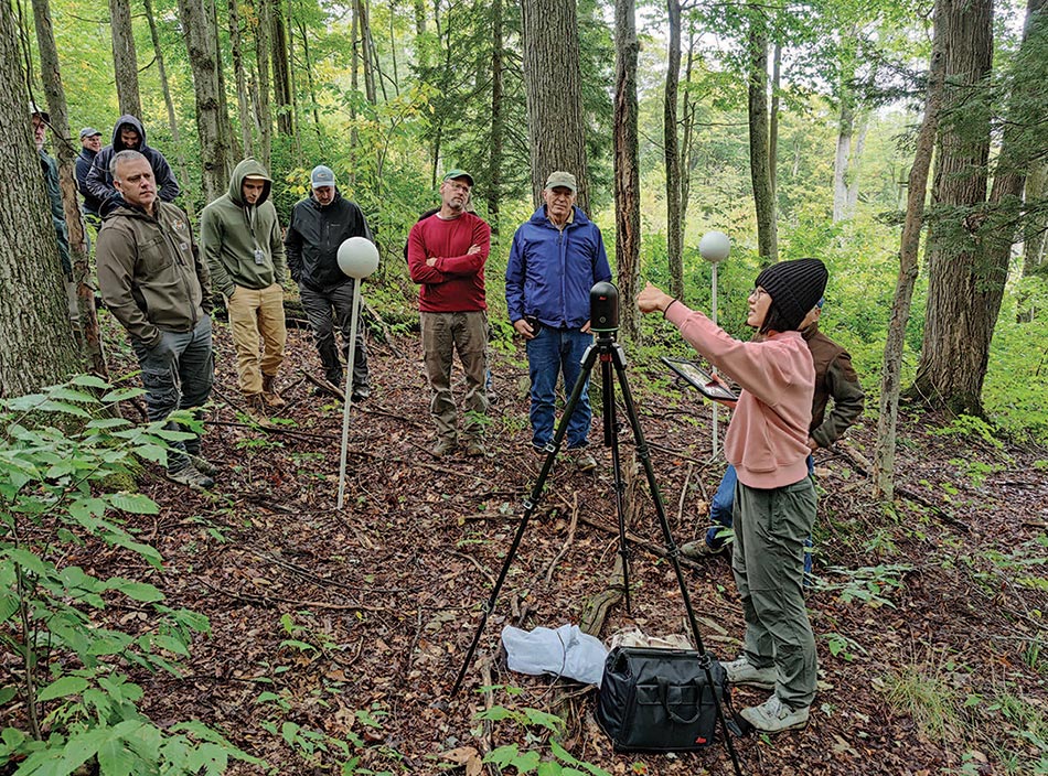
Xiangtao Xu, assistant professor of Ecology and Evolutionary Biology at Cornell University, is at the forefront of a new technology called terrestrial laser scanning (TLS), which he uses to study the structure and function of forests in order to better understand their carbon allocation patterns. TLS involves the use of a portable, usually tripod-based light detection and ranging (lidar) system to scan a small section of forest from ground level, creating a three-dimensional, highly detailed digital map in a radius around the device. As with other lidar systems, TLS works by emitting pulses of infrared light that bounce off objects and are picked up by a detector. Distance to objects is determined by the time delay of the returning signal.
Researchers have used satellite or aerial-mounted lidar systems for several decades, allowing them to quantify forest canopy height and leaf area profile. But due to low beam density, resolution is not great enough to answer more specific structural questions about forests, such as the amount of aboveground biomass (a proxy for carbon) that they contain. Obtaining that data used to require destructive sampling of a patch of forest – cutting, measuring, and weighing limbs, branches, understory vegetation, and deadfall – work that was resource-intensive, costly, and error-prone.
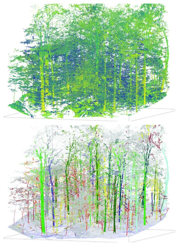
TLS data are interpreted by specialized algorithms to calculate an entire suite of measurements: commercial/bole height, density, layering, diameter at breast height, basal area, aboveground biomass, growth rate, understory density, and the amount of downed wood. TLS also enables quantification of variables that are impractical to measure manually and that have direct implications on carbon allocation and fire-risk management in forests, including branch size, position, and orientation.
Xu’s lab is also using TLS to answer both basic and applied questions in forest ecology. For example, to what extent do plant structural traits (for instance, height-diameter relationship, leaf-angle patterns, and branching patterns) vary across species and space? How do these factors influence plants’ competition for resources such as light, the amount of carbon forests can store, and timber value?
Xu hopes to develop an efficient and generic workflow for TLS methods that can be applied anywhere. The Northeast, for example, contains a majority of second-growth forest ranging from thick regenerating young stands to tall, closed canopy stands with a relatively open understory. TLS is well suited to track changes in forest structure in planted or highly managed stands such as these, he says, with lessons that can be applied to early and mid-successional forests worldwide.
Several challenges remain, however. First, TLS generates enormous data sets, and researchers must work closely with computer scientists to develop and refine algorithms that interpret the data. Second, there is a lack of published data to corroborate TLS findings, and models are not always applicable for generalizing from local studies. Researchers, including Xu, have committed to making the algorithms they use open-source in order to speed up innovation. Last, there is a general tradeoff between sampling efficiency (for example, hectares of forests covered per hour) and sampling accuracy (for instance, the number of valid laser points per meter squared) in lidar measurements. The ideal sampling protocol for different application scenarios requires more investigation.
The next steps in this research will be focused on extending the applicability of TLS techniques across biomes and integrating it with machine learning. For example, can TLS learn to identify individual species through leaf and bark patterns? Can it be used to evaluate wildlife habitat, or to assist with fire hazard assessments? As the technology becomes smaller with greater computing power, it is likely to become more widely adopted, and new avenues of research will continue to open. Even newer iPhone models, for example, have basic lidar systems.