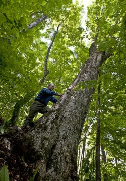
On a steep slope in the woods above our house, one particular sugar maple stands out for both its great size and its longevity. Some of the lichen-covered bark is sloughing off its trunk, but no woodpeckers have been probing it for insects, so it seems sound. And that’s remarkable for a tree that was a seedling in 1832, the year Andrew Jackson was elected to a second term as president.
The dominant tree in its neighborhood, it forks 20 feet up into a spreading crown that has relegated newcomers to the understory, and at 28 inches across, it is twice the diameter of its neighbors. All of the other outsized trees in our woods got their start as pasture trees, as indicated by their heavy lower limbs and multiple trunks. This one’s form confirms the opposite, that of a tree that grew up competing in a forest. In the long process of self-pruning, it was shedding lower limbs before the Civil War.
Loggers passed it by on various occasions, probably because it has a pronounced lean and a prominent seam that compromise its lumber value. It had a 15-inch diameter in 1954, when logger Walter Dunklee bought the timber on this lot and drove his Army surplus deuce-and-a-half deep into the woods to truck the logs out. He didn’t cut it.
Nor was it cut 16 years earlier, when the local bobbin mill bought the rights to harvest “all the beech, birch, and maple timber standing and blown down” in the worst wind that ever hit central Vermont, the hurricane of 1938. While many nearby trees were uprooted, this maple stood firm in winds that gusted at more than 100 miles per hour. Such a performance makes it worthy of a name, and I’ve christened it Andrew Jackson.
From the moment I learned that these woods had been blown down on September 21, 1938, I wanted to know more about the hurricane, but nobody living on our land that day was still around to tell me about it. Nobody could describe to me the wind, the sky, the sound of the crashing trees, or tell me what it was like to wake up the next morning to a changed world. Fortunately, other people in town had experienced it, so I went visiting.
I went to see Harry Brainerd, who was 12 years old when the hurricane hit. Harry lives four miles west of our woods, on Taplin Hill, in a white cape-style farm house, which, along with its large white barn, once belonged to his great-grandfather. The buildings perch on a knoll, with acres of lush hayfield in the foreground, the very image of a well tended New England farm.
Harry and I sat at his kitchen table while he told me about the hurricane. He said he’d been carried to and from school that day because he had been suffering from rheumatic fever.
“When I came home in the afternoon, I was sitting by the window. School didn’t let out until four o’clock back in those days, and I was sitting in the chair right there. I noticed that the little trees were bending right over, about 20 minutes past four. I thought ’twas awful windy but we just didn’t pay much attention.” His mother still had clothes out drying on the line.
The wind kept coming, and the skies got darker. A mile to the west, Harry’s classmate Bryce Metcalf saw maple trees on the ridge start toppling over, roots and all. The Metcalf farm, surrounded by hay meadows and cornfields, was just as exposed to the wind as the Brainerds’, and Bryce’s father was worried that the barn roof might lift off. He decided to clinch the nails that were holding the metal roof to the strapping, and Bryce and the hired man went with him. The hay was piled right to the roof, so the three of them climbed up on top of it and started bending the nails over.
“All of a sudden my father could see the whole roof starting to lift up,” Bryce said. “He got us out of there, and the whole thing started to go, and then, finally, part of it went off.”
Back at the Brainerds’, Harry watched the radio aerial fly off the barn. The family had a Wards airline radio and listened to Lowell Thomas report the news of the world. Even if the radio had kept working, it wouldn’t have warned them about the storm. Weather forecasting in the ’30s relied on primitive tools, and the hurricane’s arrival was a shock to all who experienced it. With electrical and telephone lines down, word did not spread north to be prepared for the winds.
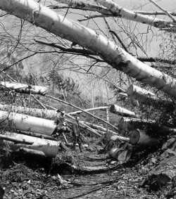
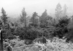
During supper, Harry was startled to see their huge barn doors bouncing end over end across the field. Yard trees began crashing onto the house. “The pine and the spruce hit the house, and when they hit the ridge pole, they broke right off, and the top part of the tree slid down the other side. It got so that every time one of them huge trees struck the house, the house just jumped right up and down. I remember my father said, and my mother too, ‘I guess we’ll be starting over again.’ We figured the barns would probably be demolished and everything else. That’s the way it was.”
As bad as it was, the damage in Corinth was just one twig in the brushpile. The path of destruction spanned 90 miles across, and forests were toppled in every New England state, with New Hampshire and Massachusetts being particularly hard hit.
The damage was so bad that the federal government formed an agency – Northeast Timber Salvage Administration (NETSA) – to deal with all the downed timber. An administrator wrote in the agency’s report, “The capricious hurricane, contacting the earth but lightly in some places, viciously in others, left wind-thrown timber in large and small bodies over some 15 million acres, or 35 percent of all the land area of New England.” He noted that damage occurred in 904 towns in 51 counties and took a bite out of the woodland bank accounts of 30,000 Depression-era landowners.
All told, an estimated 2.6 billion board feet were blown down. To put that in context, a typical truckload of logs holds 6,600 board feet. It would take almost 400,000 of these trucks to transport the wood that was blown down.
Here’s another way to think of it. The largest hardwood sawmill operating today in New England is Cersosimo Lumber in Brattleboro, Vermont. It buys 40 million board feet of sawlogs annually. At their current rate of production, it would take Cersosimo 65 years to process 2.6 billion board feet.
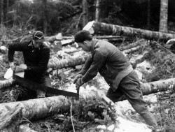
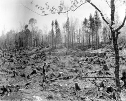
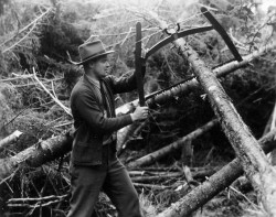
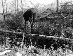
As it was, spurred on by NETSA and with help from the New Deal’s Works Progress Administration and Civilian Conservation Corps programs, the industry geared up and sawed nearly half of the blowdown into lumber. Cutting with axes and crosscut saws, and skidding logs with horse-drawn sleds, thousands of men participated in what has to be the largest logging job ever.
The Worst Storm
In the last two years, devastating tropical storms have pummeled the Northeast. Irene in August 2011 was particularly hard on Vermont, while October 2012 found Sandy walloping New York City and New Jersey. These two storms, the second dubbed a “superstorm” by those who traffic in hyperbole, can provide a framework for picturing what happened on September 21, 1938. Out on the ocean, both storms reached hurricane status – defined as having sustained winds of over 74 miles per hour – but each had been downgraded to a tropical storm by the time it made landfall. Each did tremendous damage to the built environment, with most of the harm coming from the deluge of rain and the tidal surge. But these storms were essentially floods. Sure, there was wind, but the hurricane-force winds they packed hit the coast hard and then dissipated as the storm traveled inland, which is typical of most hurricanes. The rain kept falling, but because a hurricane gathers its power from warm ocean water, the winds lost their force upon landfall.
The Hurricane of 1938 was unique in that it carried brutal winds 300 miles inland. It brought plenty of rain as well, but less than had fallen the previous week in a separate low pressure system that stopped dumping rain only the night before. One point that has been lost in the retelling is that much of New England was already flooded when the 1938 hurricane entered the picture.
On making landfall, Irene moved along at 15 miles per hour, a speed typical for hurricanes, which don’t seem to be in a hurry. They poke along, and it can take days for a huge system to work its way through any particular spot on its path. Not so on September 21, 1938. With a forward speed of 57 miles per hour, this hurricane sped from a position east of Cape Hatteras to the south shore of Long Island in only seven hours. Its center crossed Long Island at 3:30 p.m.; Hartford, Connecticut, at 4:30; the Vermont border at 6:00. High winds preceded the center’s arrival and continued after it passed, but the storm was over relatively quickly, thus the aptness of its early moniker, the Long Island Express. (The naming system that we know today didn’t come into being until 1952.) The strong winds in any one locale lasted no more than five hours, peaking for only an hour or so.
White Pine Was Most Vulnerable
One of the hardest hit landowners was Harvard University, which has owned a research forest in Petersham, Massachusetts, since 1907. Harvard Forest encompassed 2,100 acres in 1938 and has grown to 3,750 acres today. Before the hurricane, the staff was actively managing its timber stands to produce income to fund research at the forest. It was also a model forest, demonstrating to the public how good forestry could benefit everyone, from the owners of the woods to the lumber industry and the workers who depend on that industry. When the hurricane blew through, Harvard’s grand experiment in sustainable forestry was rendered to splinters.
In residence that autumn was a new graduate student named Willett Rowlands, who was quickly enlisted to document the extent to which the various stands had been blown down. With a clipboard and camera in hand, he scrambled through blowdowns and got himself covered with oozing pine pitch every day as he documented each plot, noting the species, direction of fall, and degree of damage.
The following year’s annual report featured Rowlands’ catalog of the forest destruction, citing at least moderate damage to 75 percent of the forest, with 16 percent (334 acres) completely blown down. They salvaged 5.5 million board feet, but showed only a slight profit because of the high costs of the operations. Most of the mature trees had fallen, so prospects for future timber sales looked dim, and Harvard Forest’s days of relying on timber income to fund research activities were over.
David Foster, the current director of Harvard Forest, is a landscape ecologist and forest historian with an abiding interest in broad-scale forest disturbance. Over the years, he and his colleagues have studied the hurricane damage across the region and published papers explaining the patterns of damage, the difference in damage to particular species, and the factors that influence whether or not a stand of trees was blown down.
It turns out that the extent of the blowdown depended largely on what kind of trees were in the crosshairs. Using Rowlands’ hard-earned data, Foster found that conifers were more vulnerable than hardwoods, and that white pine – the region’s tallest and fastest growing tree – was the most vulnerable of all. As a rule, older, taller trees were more susceptible than shorter, younger trees, but in the case of pine, even 15-year-old individuals were knocked over. At 30 years, entire stands of pines were flattened. Pine accounted for nearly 90 percent of the timber salvaged in New England. Hardwoods, which in general have a stronger root system, weren’t blown down unless they were taller, which meant they would have been considerably older than the fast-growing pine. Massachusetts and New Hampshire had a preponderance of pine in their woods at the time, which explains why they suffered the greatest losses. Whether conifer or hardwood, the taller the tree, the more likely it was to uproot. Think of a tree as a lever. The taller the tree, the longer the lever and the greater force it’s capable of exerting on the ground where it’s anchored. Older forest-grown trees tend to be taller and have their crowns concentrated in the top third of the tree, so they transfer more of the wind’s force to the ground. They are also more rigid and less capable of bending, so something has to give – it’s simply a question of whether the trunk is stronger than the roots. In 1938, the roots gave out much more frequently than the trunks. Less than 15 percent of the pine trunks broke, and an even smaller percentage of hardwoods snapped off.
The same principle explains why many of the old pasture trees were left standing. Open-grown trees are short; with no competition, they put their energy into growing branches and not a tall trunk – so the wind’s leverage is greatly reduced. And while more branches mean more area to catch the wind, pasture trees have spent a lifetime dealing with wind, so they’ve developed stronger root systems. Similarly, trees lining the edge of a field gain wind-firmness from years of being buffeted by wind from at least one flank, and they held their ground better than trees deeper in the forest.
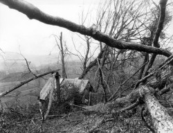
Foster points out that, across the region, the damage was surprisingly variable. If you had flown over New England in a plane, you would have seen a mosaic of damage, with many shades of gray between the blocks of black and white. Some large patches were flattened, and others had more than half their trees blown down. But in some forests the trees were merely inconvenienced by having their leaves stripped just a couple of weeks before they would normally have dropped. And some stands escaped damage altogether. You would have seen damaged trees on 35 percent of the land area – slightly more than 15 million acres. But only four percent – 600,000 acres – were absolutely flattened.
The determining factor was a site’s relative exposure to the wind, and in interior New England, hurricane winds are always strongest from the southeast. That’s because hurricanes arrive in New England from a generally southerly direction. Those that come from the west or southwest have diminished winds because they’ve traveled over land, and are more likely to cause some rainy days rather than a full-blown disaster. Same thing if the track takes the storm out to the Atlantic: rain but no appreciable wind. But in the exceptional case when a hurricane heads due north in the Atlantic and avoids landfall as long as possible, it will pack all its winds with it.
That’s what happened in 1938. Tracking from south to north, the hurricane sped forward at 57 miles per hour. If it had been a straight line storm, the winds would have been 57 miles per hour from the south, which would have been plenty. But because hurricanes are cyclonic systems, the counter-clockwise winds can either increase or diminish the effect of the forward motion, depending on your position relative to the path. The strongest winds were to the east of the track, where the forward motion was added to the rotational wind. In this case, sustained winds from the southeast of 50 to 80 mph combined with a forward speed of nearly 60 mph to produce winds of 110 to 140 mph.
On the other hand, locales to the west of the storm track saw the forward momentum more or less canceled out by the winds blowing from the north. The illustration on page 26 shows the mechanics of this, and it holds true for hurricanes in general. The east side of the storm track has more wind, the west side has more rain. In 1938, the rapid forward speed exacerbated the difference.
In the absence of any strong topographical features, all areas to the east of the storm track would be similarly exposed. Gently rolling terrain doesn’t change the equation much. But any hill open to the southeast wore a bull’s-eye – the steeper the slope, the more pronounced the bull’s-eye.
Foster’s colleague Emery Boose has created computer models that reproduce the conditions of historical hurricanes. By entering weather observations and historical documentation of damage on a town-by-town basis, Boose created a model of the storm track and speed, the timing of arrival at any location, and the wind speed and direction for that location over the duration of the storm.
I asked him to run the model for Taplin Hill in Corinth, and he sent me an Excel spreadsheet showing, among other things, wind speed and direction at 5-minute intervals. From it, I could chart the rise and fall of the wind, the period at which it reached its peak, and the ongoing change in direction as the center passed to the west. It matched up well with eyewitness reports and newspaper accounts. The strongest sustained winds were between 8 and 9 p.m. at 77 miles per hour, with gusts reaching 117 miles per hour. They came from the east and then slightly south of east (from 93 to 119 degrees).
Our land, only four miles away, would have experienced the same wind speed and direction. And our hillside, with its 30 percent slope facing east, definitely wore a bull’s-eye, which makes the continued presence of Andrew Jackson, the 180-year-old sugar maple, even more impressive.
Trees Can Talk
I owe my knowledge of Andrew Jackson’s history to a forestry tool called an increment borer and to Dave Orwig, the forest ecologist at Harvard Forest who showed me how to use it. Orwig has cored thousands of trees, counting their annual rings to determine their age. More important to Orwig than age, though, is what the tree’s pattern of growth tells him about the conditions it lived through.
An increment borer is a drill bit that is hollow in the center. When it’s threaded deep into a tree and aimed for the center, a core of wood about the circumference of a pencil can be withdrawn. This core shows the growth rings, which tell the story of lean years (or even decades) when the tree added little girth, interspersed with wider rings that correspond to more favorable conditions. Orwig set me up at a microscope in Harvard Forest’s herbarium and showed me how to use dendrochronology software to record each increment of the tree’s growth.
We had a logging job in our woods that fall, which provided me with cookies (inchthick cross sections) sliced from the ends of freshly cut trees. I examined these under the microscope in the same way and, with data from 16 cookies and cores, Orwig showed me how to interpret what I found.
All of the trees were alive in 1938, and many were 40 or so years old when the hurricane hit. Except for Andrew Jackson, none of them was more than three inches in diameter in 1938, and their growth rings were very tight. It took these trees thirteen years to add an inch in diameter, which is very slow growth, and that’s the best they were doing. Some were growing even more slowly. Clearly, they’d been languishing in the understory.
But when the overstory trees blew down in 1938, these smaller trees didn’t blow down with them. Nor were these survivors crushed by falling trees. Their final bit of good fortune was that they managed not to be in the way of the loggers salvaging the timber that had blown down. So when they were suddenly free to grow, they took advantage of it and grew rapidly for the next few decades. It took two or three years for them to recover from the stress of sudden change, but once they recovered, they really took off.
Andrew Jackson’s experience differed only in that it was a larger tree when the hurricane hit. It had taken a century to grow 11 inches (hampered by a four-decade stretch, starting in 1847, in which it added only an inch), but following the hurricane it added nine inches in just 30 years. It went from a growth rate of 1.1 inches per decade to three inches per decade. Clearly, for this tree the hurricane was a godsend.
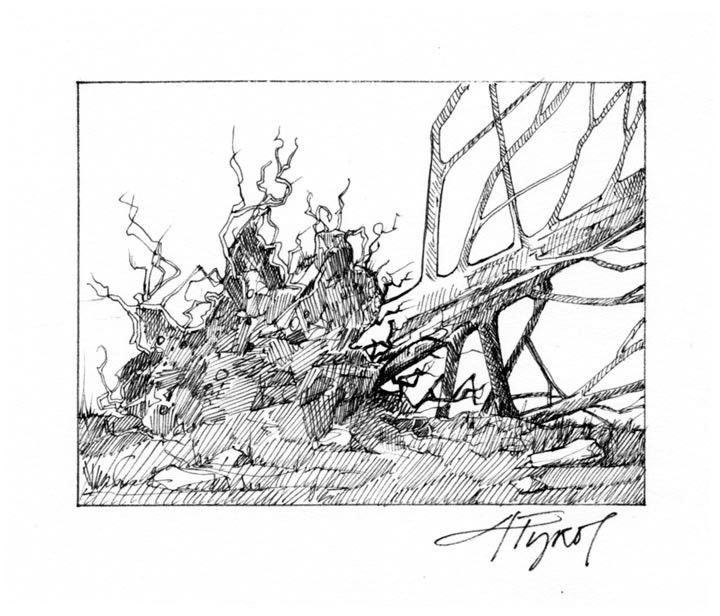
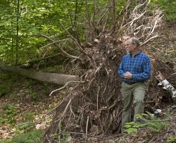
This hillside, like others blown down in the hurricane, is pockmarked with deep depressions adjacent to correspondingly large mounds. This pit and mound topography looks as if somebody dug a hole and piled the dirt next to it, and it happens anytime the wind uproots a tree. As the roots are ripped from the ground, they carry a mass of soil and stone, excavating a hole. The bigger the tree, the bigger the hole. Over time, the roots and stump decompose, leaving a mound of earth.
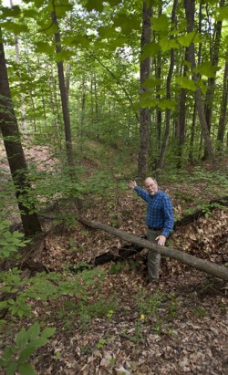
One of the more interesting things about this topography is that decades after the tree went down you can stand in the pit, look out across the mound, and see exactly where the tree fell. The 1938 hurricane’s winds came from the southeast, so the conventional wisdom has long held that trees fell to the northwest. But on our hillside, most of the pit and mound pairs faced east, downhill.
Something was wrong.
I invited David Foster to have a look, and we spent a February morning exploring the hillside. Foster agreed that the pits and mounds showed that trees fell to the east, and he raised the possibility that these pits and mounds had been produced at another time. Maybe some portion of our woods had blown down in 1938, but the pits and mounds in front of us were from other events. Given that the prevailing wind is from the west, all these trees could have fallen over at other times.
Clinging to my assumption, I proposed that the 30 percent slope came into play. Perhaps gravity trumped the power of the wind, and the trees rocked back and forth and followed their weight downhill. But Foster pointed out that white pine had fallen uphill on east-facing slopes that were every bit as steep as ours. And indeed, I’d seen that at Harvard Forest. In fact, I’d seen not just the pit and mound, but the pine stumps, identified as such by remnant branch whorls. It may seem peculiar, but softwoods rot more slowly than hardwoods, which typically disintegrate within fifty years.
It’s human nature to relish a good disaster – how else to explain the attraction of the Weather Channel? – and so it pained me to even consider the possibility that the hurricane had somehow passed our woods by. At Foster’s recommendation, I sought guidance from Charlie Cogbill, a Vermont forest ecologist and historian with connections to both Harvard Forest and Hubbard Brook Experimental Forest in North Woodstock, New Hampshire. An aficionado of blowdowns, Cogbill has his own shorthand for the various ways trees are affected by wind: high snap, low snap, tipup, pistol butt. He had documented the hurricane and salvage at Hubbard Brook, which, like ours, is largely a northern hardwood forest. He was intrigued by what he saw in our woods, but he wasn’t any readier than Foster to jump to conclusions. “Get the data,” Cogbill said. “And then we can see if something different happened here.”
In full sleuth mode now, I climbed the hill with my compass and notebook, recording compass bearings for 58 of the most prominent pits and mounds. While they didn’t all fall in the same direction, the majority fell to the east or just south of east. At each pit and mound, I took compass bearings for the aspect (the direction the hill faces) and it averaged just south of east. This data confirmed that the trees’ direction of fall was much more closely linked to the hill’s direction than to wind direction. In other words, they had fallen downhill.
I wanted to see if our hillside was an anomaly, so I visited Harry Brainerd’s sugarbush, which had been laid low in 1938. One of the slopes pitched to the east, just like ours, and on it 12 out of 15 trees fell downhill instead of to the northwest. Next, I visited Hubbard Brook, where I confirmed that trees on their southeast facing slopes had fallen downhill.
Any logger will tell you how difficult it is to fell a tree uphill. Gravity is working against you, and the crowns are heavier on the downhill side. All the way up the slope, the uphill trees overtop the trees below, so they can expand their crowns to the light. On their back sides, facing the hill, their crowns are smaller because they are shaded by the trees above. This produces a lot more weight on the downhill side.
I was convinced that gravity was stronger than 100 mile an hour winds, and I had some data to back up my supposition. But really all it proved was that on these slopes, the trees fell downhill. It didn’t prove that they had fallen downhill during the hurricane. The only way to know that was to determine how old the mounds were. One more bit of detective work was required.
Foster pointed out that I could ascertain the age of a mound by determining the age of a tree growing on it. If the tree’s origin was prior to 1938, the mound pre-dated the hurricane. He suggested I look for paper or yellow birch because these species find the disturbed soil of an exposed rootball particularly hospitable as a seed bed, meaning they would germinate soon after the tree fell. But our woods are heavy to sugar maple and, sure enough, that’s all I could find. Two mounds had sugar maples growing on them. The first stood on a mound facing 49 degrees (northeast); the second on a mound oriented 98 degrees (nearly due east). I borrowed an increment borer from Dave Orwig and extracted cores. I glued them to the ready-made holders and began sanding according to Orwig’s instruction, starting with 125 grit, then 200 grit, then 400 grit sandpaper, until they were polished like a piece of fine furniture.
I have to admit, my heart was racing when I brought the first core into focus on the microscope. I marked each decade with a pencil dot and went backwards. 2010, 2000, 1990.... The first tree was from 1943, the second from 1942. Bingo. These maples had seeded onto mounds formed a few years earlier, when the trees blew down in 1938.
Still, I knew that I needed to replicate these results in another forest to be sure, so I went back to Hubbard Brook and got permission to core some trees. I found four trees on downhill mounds, two white ashes and two yellow birches. I went through the same process, and the white ash trees turned out to have been seedlings in 1956 and 1960, which showed only that the mounds they grew on were older than that – not very conclusive.
I knew the yellow birches were better bets, but the first one was a bust because its core had a small section of rot where the rings didn’t show up. I had no way of knowing how many years were eaten up by that gap.
But I hit paydirt with the second yellow birch. This 13-inch diameter tree was a seedling in 1942. It was standing on the mound of a tree that had fallen to the southeast (142 degrees). This birch and the two maples on my hillside showed that the mounds that provided their seedbed had been formed just before 1942.
All trees have their own characteristics, and it’s not that much of a stretch to suggest that hardwoods would behave differently than less windfirm white pines when faced with catastrophic wind. It seems that in this case, at the height of the storm, gusts exceeding 100 miles per hour kept the trees swaying back and forth. A gust would push the crown in the uphill direction, then let up. “It was the tree rebounding back in the downhill direction that stretched the roots to the breaking point,” Cogbill said. “The torque from the rebound was enough to break the roots, and they failed under tension on the uphill side.” And down they went, some like dominoes, others on their own.
It took me a while, but I now have a clear picture of what happened on our hillside. And, yes, it pleases me to know that it was the hurricane that knocked all those trees over. Our woods are like many across New England, a story of devastation and recovery. And the recovery came naturally; region-wide, almost none of the blown down forests were replanted.
Walking through these flourishing woods today, it is hard to imagine the devastation attending their birth. Seventy-five-year-old trees seem mature and the full canopy of our woods seems ageless. Let’s just say that we’re blessed to have forests that are so resilient.
That perspective and that sentiment would have provided little solace to the people who ventured into their woodlots and sugarbushes after the storm passed. Bryce Metcalf said, “The next day, my father and I walked out there. It was just a jungle. You couldn’t get through it, so many trees were down. And the trees that were left standing had branches and limbs blown off so they never ran sap like they did previously. It pretty near ruined our sugar place.”
In 1938, when practically every Vermont farmer relied on income from maple sugaring, that was indeed a cruel blow.
This article was supported by Northern Woodlands magazine's Research and Reporting Fund, established by generous donors.


Discussion *