Skip to Navigation Skip to Content
Decorative woodsy background

Clouds: More Than Meets the Sky

cumulonimbus_800.jpg
Photo by Chris Bouchard.

Take our cloud quiz!

I grew up near the water in Brunswick, Maine, where warm mornings are often shrouded in a thick deck of clouds. On the coastal plain, moist south winds cool as they pass over the chilly waters of the Gulf of Maine, causing blankets of fog. It can be mid-morning before the sun breaks free and puffy fair-weather clouds dot the azure sky.

Brunswick, with its distinctive seasons and smog-prone summers, was a good place to be if you were a kid interested in clouds. The sky had personality. I can clearly remember in 1996, when I was 16 years old, a freak late-spring thunderstorm that towered to the unusual height of 60,000 feet. It bore the classic flattened anvil at its summit, and looked eerily similar to the mushroom cloud of a nuclear explosion.

As the storm neared, the sky began to blacken, and the thunder grew louder. I ran inside and ransacked my room for my 35-mm camera. When I returned, the sky was blacker than I had ever seen it; it was as if someone had unfurled a giant sheet of carbon paper over the sky. Vivid bolts of lightning appeared on the horizon, some of them flickering for close to two seconds.

Elated, I held the camera to my eye and shot the cumulonimbus clouds and the lighting, then afterwards the giant bulbous pouches – called mammatus clouds – that protruded from the underside of the storm’s anvil cloud cap.

It was my first successful shoot of a severe thunderstorm. Or so I thought. A week after the event, my mother returned from the drugstore to tell me that none of the photographs had come out. Apparently, in my haste to dash into the storm and capture the action, I had not loaded the film correctly.

Years later, I went on to become a meteorologist and, perhaps to make up for my failed first attempt, I still carry a camera wherever I go, ready to capture the drama of the skies. Despite years of observing clouds, I never tire of their shapes and their stories. Collected here are a few of my cloud images from over the years, with descriptions of what they signal about the atmosphere. I hope they will pique your interest in clouds and inspire you to head out into the field to watch them in their natural splendor.

Join the Community of Observers

Meteorologist Chris Bouchard and a team of naturalists and educators from the Fairbanks Museum and Planetarium in St. Johnsbury, Vermont, are seeking your help in establishing a database that tracks clouds and weather patterns, migratory birds, butterflies, and wildflowers. The project is called The Community of Observers program, and the idea is to enlist the help of citizen scientists to track how the landscape is changing, from season to season and, in this era of climate change, over longer periods of time. The group’s aim is to provide a forum for observations – anecdotal as well as quantitative.

The museum’s meteorologists have recently digitized weather records dating back to 1894. These records represent the longest continuous weather data stream at a single site in Vermont, and the trends they reveal offer clues to the nature of change in the region. Weather observers who participate in the Community of Observers program will build similar data sets, and contribute directly to ongoing studies of the weather trends affecting our region. The museum will also be tracking the migratory patterns of 15 bird species, the populations of 12 butterflies, and the bloom dates of 25 wildflowers. In each case, the species are easy to identify, so that people at all levels of experience can contribute.

A new website will map observations and provide access to collected data, including the museum’s records of first bloom dates, which reach back to 1904.

Learn more about how you can become a Fairbanks Observer at www.fairbanksmuseum.org, or call Leila Nordmann, Program Director at the Fairbanks Museum and Planetarium at (802) 748-2372.

The mapping tool on the website is limited to Vermont and northern New Hampshire, but there are several other sites for those interested in collecting data outside this region, such as the National Phenology Network, eBird, through the Cornell Lab of Ornithology, the North American Butterfly Association, and The Appalachian Mountain Club.
Clouds Gallery

A. Cirrus: Thin, wispy, and made of ice crystals. Cirrus clouds are composed of ice crystals. They are thin, wispy, and fibrous. Often, long, discrete tendrils of falling snow can be seen on their undersides. They indicate moisture at high altitudes and can signal the approach of stormy weather hours or even days in advance. Because they are composed of ice crystals, cirrus clouds can create interesting optical effects when sunlight or moonlight passes through them.
A. Cirrus: Thin, wispy, and made of ice crystals. Cirrus clouds are composed of ice crystals. They are thin, wispy, and fibrous. Often, long, discrete tendrils of falling snow can be seen on their undersides. They indicate moisture at high altitudes and can signal the approach of stormy weather hours or even days in advance. Because they are composed of ice crystals, cirrus clouds can create interesting optical effects when sunlight or moonlight passes through them. | Photo: Chris Bouchard
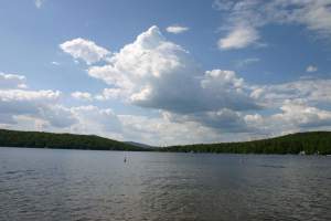
B. Cumulus: The puffy fair-weather friend. These familiar, puffy white clouds often develop over mountains during a summer afternoon. They may appear on an otherwise sunny day in warmer months, and they indicate that the atmosphere is becoming unstable.
B. Cumulus: The puffy fair-weather friend. These familiar, puffy white clouds often develop over mountains during a summer afternoon. They may appear on an otherwise sunny day in warmer months, and they indicate that the atmosphere is becoming unstable. | Photo: Chris Bouchard
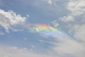
C. Halo: Ring around the moon. This optical phenomenon is caused by light refracting through tiny ice crystals. It most commonly occurs when light passes through thin, icy, high-altitude clouds, but can also occur with such clouds near ground level in winter months. It appears as rings, spots, and pillars.
C. Halo: Ring around the moon. This optical phenomenon is caused by light refracting through tiny ice crystals. It most commonly occurs when light passes through thin, icy, high-altitude clouds, but can also occur with such clouds near ground level in winter months. It appears as rings, spots, and pillars. | Photo: Chris Bouchard
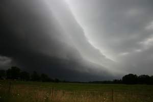
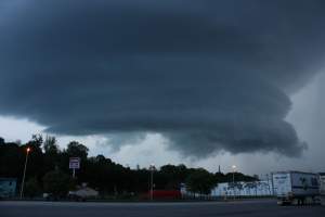
D. Shelf: Strong winds may be coming your way. These dramatic, low-level, horizontal clouds are typically attached to the dark bases of thunderstorms. They form when cold air rushing away from the core of a thunderstorm forces warmer, moist air around the storm upward, causing condensation. As stable layers of air rise, they may condense into even, distinct cloud layers, giving the shelf cloud a stratified appearance, much like a stack of plates. These clouds typically form during the warmer months, and are associated with strong winds, sharp temperature drops, and sharp pressure rises.
D. Shelf: Strong winds may be coming your way. These dramatic, low-level, horizontal clouds are typically attached to the dark bases of thunderstorms. They form when cold air rushing away from the core of a thunderstorm forces warmer, moist air around the storm upward, causing condensation. As stable layers of air rise, they may condense into even, distinct cloud layers, giving the shelf cloud a stratified appearance, much like a stack of plates. These clouds typically form during the warmer months, and are associated with strong winds, sharp temperature drops, and sharp pressure rises. | Photo: Chris Bouchard
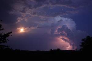
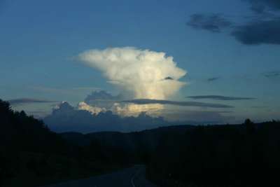
E. Cumulonimbus: Hulking beasts of an unstable atmosphere. Cumulonimbus clouds are the giants of the skies. Reaching heights of up to 70,000 feet, they are massive clouds that most often form during warmer weather when pockets of relatively warm air near the ground rise into cooler air aloft. Thunder and lightning – and sometimes flooding, hail, damaging winds, and tornadoes – are associated with these clouds. They often have flattened tops called anvil clouds.
E. Cumulonimbus: Hulking beasts of an unstable atmosphere. Cumulonimbus clouds are the giants of the skies. Reaching heights of up to 70,000 feet, they are massive clouds that most often form during warmer weather when pockets of relatively warm air near the ground rise into cooler air aloft. Thunder and lightning – and sometimes flooding, hail, damaging winds, and tornadoes – are associated with these clouds. They often have flattened tops called anvil clouds. | Photo: Chris Bouchard
F. Wall: Take cover! These dramatic dark clouds are rare in the Northeast, but can spell trouble. They develop at the base of a cumulonimbus cloud that has taken on rotation. Often, this rotation is clearly visible within the cloud, and if it strengthens sufficiently, a tornado may form at its core. If a wall cloud is coming your way, you should take shelter immediately!
F. Wall: Take cover! These dramatic dark clouds are rare in the Northeast, but can spell trouble. They develop at the base of a cumulonimbus cloud that has taken on rotation. Often, this rotation is clearly visible within the cloud, and if it strengthens sufficiently, a tornado may form at its core. If a wall cloud is coming your way, you should take shelter immediately! | Photo: Chris Bouchard
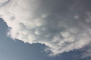
G. Mammatus: May mean a thunderstorm is in the vicinity. When moist pockets of air descend from a cloud into the drier air below, pouch-shaped mammatus clouds form. These are most often seen hanging below anvil clouds, although they occasionally protrude from other types of clouds as well. These clouds are most common in the warmer months, and often indicate that a severe thunderstorm is nearby.
G. Mammatus: May mean a thunderstorm is in the vicinity. When moist pockets of air descend from a cloud into the drier air below, pouch-shaped mammatus clouds form. These are most often seen hanging below anvil clouds, although they occasionally protrude from other types of clouds as well. These clouds are most common in the warmer months, and often indicate that a severe thunderstorm is nearby. | Photo: Chris Bouchard
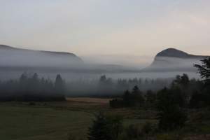
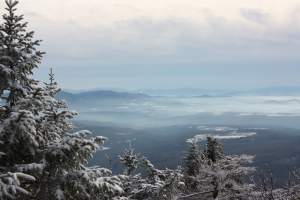
H. Fog: A cloud on the ground. Fog is a ground-level cloud that can form in a number of ways, but most often when air cools to its dew point. While fog frequently forms in valleys and hollows during clear, cool fall nights, clouds enveloping mountaintops can also be considered fog.
H. Fog: A cloud on the ground. Fog is a ground-level cloud that can form in a number of ways, but most often when air cools to its dew point. While fog frequently forms in valleys and hollows during clear, cool fall nights, clouds enveloping mountaintops can also be considered fog. | Photo: Chris Bouchard
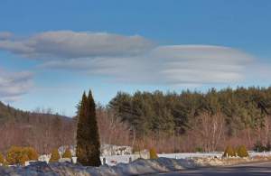
I. Lenticular: A UFO in the skies. Similar in appearance to pileus clouds, these thin, lensshaped clouds typically form over large mountains. Because of their circular shape, they are sometimes mistaken for flying saucers Lenticular clouds form when stable layers of near-saturated air are forced upward by mountainous terrain and cool to the dew point. These clouds sometimes form in stacks.
I. Lenticular: A UFO in the skies. Similar in appearance to pileus clouds, these thin, lensshaped clouds typically form over large mountains. Because of their circular shape, they are sometimes mistaken for flying saucers Lenticular clouds form when stable layers of near-saturated air are forced upward by mountainous terrain and cool to the dew point. These clouds sometimes form in stacks. | Photo: Chris Bouchard
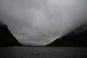
J. St rat us: Long and low shrouds. These horizontal, relatively shallow clouds occur at lower altitudes and are common over the Northeast during fall and winter. They are usually gray in appearance, and can shroud mountain peaks in fog. When accompanied by rain or snow, they are known as nimbostratus.
J. St rat us: Long and low shrouds. These horizontal, relatively shallow clouds occur at lower altitudes and are common over the Northeast during fall and winter. They are usually gray in appearance, and can shroud mountain peaks in fog. When accompanied by rain or snow, they are known as nimbostratus. | Photo: Chris Bouchard
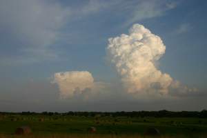
K. Towering Cumulus: Showers and thunderstorms may be near. These tall, turbulent clouds appear to explode upward into the skies, and are caused by rapidly rising currents of air. They may or may not produce precipitation, and can sometimes grow into thunderstorms. They are most common when it’s warm, and they indicate that the atmosphere is unstable.
K. Towering Cumulus: Showers and thunderstorms may be near. These tall, turbulent clouds appear to explode upward into the skies, and are caused by rapidly rising currents of air. They may or may not produce precipitation, and can sometimes grow into thunderstorms. They are most common when it’s warm, and they indicate that the atmosphere is unstable. | Photo: Chris Bouchard
L. Smog: Smoke + fog = smog. Smog is a combination of smoke and fog – a loose term given to clouds caused by pollution. In the Northeast, smog is sometimes seen when winds transport pollution from large cities. This is most noticeable during the summer months, when high levels of water vapor aid in making it visible. In the winter, areas of concentrated smog can form during a temperature inversion – when cold air is situated below warmer air. Because cold air is dense it resists movement, resulting in very light winds that allow pollution to accumulate from manmade sources, such as car exhaust. Smog is a common sight in narrow mountain valleys during the winter.
L. Smog: Smoke + fog = smog. Smog is a combination of smoke and fog – a loose term given to clouds caused by pollution. In the Northeast, smog is sometimes seen when winds transport pollution from large cities. This is most noticeable during the summer months, when high levels of water vapor aid in making it visible. In the winter, areas of concentrated smog can form during a temperature inversion – when cold air is situated below warmer air. Because cold air is dense it resists movement, resulting in very light winds that allow pollution to accumulate from manmade sources, such as car exhaust. Smog is a common sight in narrow mountain valleys during the winter. | Photo: Chris Bouchard

No discussion as of yet.

Leave a reply

To ensure a respectful dialogue, please refrain from posting content that is unlawful, harassing, discriminatory, libelous, obscene, or inflammatory. Northern Woodlands assumes no responsibility or liability arising from forum postings and reserves the right to edit all postings. Thanks for joining the discussion.